http://www.outdoorjapan.com/magazine/department_details/58
The (incomplete) Guide to Sea Kayaking in Japan
2010
ISSUE
35
The (incomplete) Guide to Sea Kayaking in Japan
By Bill Ross and Shiro Ose
Top paddling around the Archipelago
An admittedly incomplete guide to the best sea kayaking around Japan
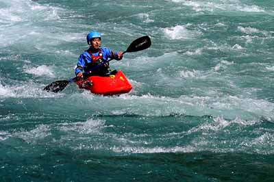
With thousands of kilometers of scenic shoreline, much of it suitably convoluted and rocky, there are lots of places in Japan to sea kayak. This is an admittedly brief look at some of the best destinations in the country, and some of the best centers for information, instruction, rentals and tours.
OKINAWA
Kerama is perhaps the top choice, not only for the quality of the conditions, but also for access from Okinawa Island. If you have more time, head out to Iriomote, Miyako and other islands.
Okinawa Qajaq Centre
1-3-6 Matsushima, Naha
info@qajaqcentre.com
Tel: (098) 882-2330; Fax: (098) 882-2331
www.qajaqcentre.com
KYUSHU
Kinko Bay, Kagoshima
This big bay, about the size of Lake Biwa, is a good place for paddlers of all levels.
Southern Works
Fukuoka City, Fukuoka
info@southernworks.com
Tel/Fax: (092) 212-8339
www.southernworks.com
Hiroshima
Itsukushima (Miyajima)
It’s not often you get to paddle in a UNESCO World Heritage Site but, with a kayak, you cannot only paddle around the famous torii in the water but elsewhere in the beautiful surroundings of the island. While development has changed much of the area, the shrine’s sacred status has kept much of the island pristine; traveling by kayak means no crowds.
Paddle Park
Hatsukaichi, Hiroshima
Tel/Fax: (0829)50-4340
www.paddlepark.com
FUKUI / SHIGA
Wakasa Bay/Lake Biwa
We’ll put these two together, because the local provider Shiro Ose (who contributed much of this information—mild disclaimer) serves both. Wakasa Bay is beautifully convoluted and rocky, with sea caves, arches and more, as well as many small, convenient sand beaches for lunch or a swimming break. The massive freshwater Lake Biwa is convenient (not much after-paddle rinsing) and a great place for beginners to first dip a paddle.
Granstream
Takashima, Shiga
ose@granstream.jp
Tel/Fax: (0740) 20-2620
http://granstream.jp
WAKAYAMA
Kii Peninsula
The whole of Kii Hanto is so big (Japan’s third-largest peninsula), it’s hard to call it a single destination, but there’s some good paddling to be found as well as a lot of history and nature. Some areas can be more challenging due to strong currents.
Kumano Experience
Tanabe, Wakayama
info@kumano-experience.com
Tel/Fax: (0735)43-0303
www.kumano-experience.com (good English website and speaking ability)
SHIZUOKA
Izu Peninsula
Some of the best, and easiest-to-access from Tokyo, paddling is on the west and south coasts of Izu, including the towns of Matsuzaki and Iwachi. Something for every level of paddler.
Surface Kayak Guide Center
Minami Izu, Shizuoka
mail@the-surface.com
Tel/Fax: (0558) 62-2114
www.the-surface.com
CHIBA
Boso Peninsula
There are many folks around Boso, since it’s so close to the city, but some good paddling as well, particularly for newer sea kayakers.
Saltys Paddle Sport (English speakers available)
Minami Boso, Chiba
info@saltys.info
Tel/Fax: 0470-20-4131
www.saltys.info
NIIGATA / ISHIKAWA
Sado Island/Awashima Island/Noto Peninsula
You read it about it, now go out and experience Sado yourself. Awashima, just north of Sado, is a much smaller island—it can be circumnavigated in about six hours—but provides rock gardens, arches, cliffs and many Sado-like experiences. Noto is a big peninsula, open to the Japan Sea on the west, scenic and historic on the east.
In Field
Myoko, Niigata
mail@in-field.com
Tel/Fax: (0255) 87-2860
www.in-field.com
IWATE
Sanriku Coastline
This rugged shoreline includes some 600 kilometers of seemingly endless cliffs, bays, arches and tiny islands—one of the most beautiful areas in the country, and again, best seen from a boat.
Mesa
Kamai, Iwate
Tel: (0193) 22-7005 / 090-4555-7971
Fax: (0193) 27-7006
www.mesasanriku.com
HOKKAIDO
Shiretoko Peninsula
The other UNESCO World Heritage Site you can paddle around; this beautiful, 43-kilometer-long peninsula is a place where you can see not only an amazing abundance of wildlife both in the water (including a variety of whales) and on land (watch out for the bears).
Shiretoko Expedition
Tel: 090-8634-0510
shiretokoexp@yahoo.co.jp
http://shiretokoexp.sports.coocan.jp
A week in the saddle paddling around Niigata’s Sado Island.
There is an upside to a recession, I thought to myself. My head down, arms paddling too hard against wind and waves to worry about getting tired. The kayak slid through the waves; its flexible frame snaking up and down, throwing spray in the air with each rise and fall.
If work hadn’t gone south, I would not have had a whole, uninterrupted week to paddle around Sado. Ogi Port, our starting point and our final destination, was quickly approaching. I grinned and felt proud of what we had done. I realized then I had hardly turned on my phone for a week; an accomplishment in itself.
Leading our group was my neighbor and fellow mountain guide Toyokazu Nakano, who always has time for an adventure. Tomokazu Watanabe is a civil servant in Niigata City, which apparently means taking time off isn’t too difficult, while Jun Tanaka, a schoolteacher in Kobe, was still on summer break. I, the happily underemployed, rounded out the group.
Day 1
The trip began with a two-and-a-half hour ferry trip from Niigata’s Naoetsu Port to Sado Island. It was not a first trip for anyone except Tanaka. Yet none of us had kayaked all the way around Japan’s sixth-largest island.
We were using folding kayaks, an ideal way of getting around since you can always bail on a trip, pack the boat in a backpack, and bus your way back to civilization if need be. When the ferry landed, our immediate task was to build and pack the boats at a nearby boat slip under the watchful eyes of the local women paddling taraibune, the traditional half-barrel boats tourists come to see in Ogi.
I wondered how they could spend all day in the tubs, dressed in short kimono, aprons, headscarves, gauntlets and the folded, face-obscuring straw hats that are a symbol of the island. They looked cool and calm, gracefully performing a difficult-looking figure-eight sculling stroke to propel the boats around the harbor.
We were now all drenched in sweat, straining over aluminum frames and Hyperlon hulls, cramming dry bags into every corner of the boats. We had arrived on the first day of Earth Celebration, the annual music festival hosted by Kodo, the acclaimed taiko group, whose village is near Ogi. We enjoyed a good curry lunch and cold drinks in the flea market before we took off. The rhythm of drums would follow us for the next two days around the southern tip of the island.
The first day would be a short one, traveling along the coast for less than five kilometers. In that short distance, we gained a sense of the beauty of the island’s coast, with countless rocky inlets, tiny islets and our first sea cave. There would be many more.
Entering a rocky bay near the town of Shukunegi, we were startled to see another taraibune coming ashore, piloted not by a local woman, but an elderly angler, festooned with bamboo poles tipped with metal hooks. In this area, we found, the boats are still used pursuing awabi (abalone) and sazai (turbo shells).
“I’m going fishing,” Watanabe announced, starting a trend that would continue for the rest of the week. Nakano decided to snorkel for some shellfish and Tanaka got out a book, while I made a half-hearted attempt to catch some mackerel.
The result of our effort was two mackerel, a couple awabi and a thirst, so we wandered into Shukunegi to hunt down some cold beer, another trend, especially paddling in hot weather with strong tailwinds during the first half of the journey. I kicked myself for not bringing my camera, though, for Shukunegi turned out to be full of interesting old buildings, an ancient well and narrow walkways between houses.
We asked a fisherman to point us toward the liquor store which turned out to be a private home (without signs). No village on Sado, we found, is too small to have a beer dispensary.
First camping dinners are never smooth. What to cook? What to share? What to eat? As darkness set in, so did the arrival of a wave of large, mottled pill bugs. We watched them swarm around a dropped fish head, cleaning it to bone in no time, until Nakano called out. “Itai! They’re biting!” So we retreated to the tents, spending an itchy night listening to them crawling over the fabric.
Day 2 Morning arrived without a bug in sight, although everything left outside—cutting boards, shells and fish skeletons—was absolutely clean. The daily routine of striking camp, loading the boats, reviewing maps and heading out for an adventurous day had begun—and I loved it.
Rounding the southern tip of Sado, we saw several more older men in taraibune, peering down through a glass-bottomed box, snagging shellfish. “Ohayo!” the puckish Watanabe would call out, inevitably startling the fishermen with a waterborne morning aisatsu.
The rock formations in this area are positively lunar, a reminder of the huge winter storms that crash in from Siberia. The result is great sea kayaking, with vast stretches of rock gardens, channels and arches to wander through.
The only downside was we all holed our boats; at one point, Watanabe didn’t know he had a gash across the hull, until he started complaining that his boat was slowing down. “You’re halfway down in the water!” Nakano shouted, hustling him off to the shore for a draining and a patch.
Sado has an unusual shape, like two separate islands lying diagonally to each other with a low-lying area filling in the space between. Our second day meant a five-kilometer-plus crossing of Mano Bay. Not a huge distance, but I learned something while barely seeing the distant coast in the haze during the crossing.
First, it feels as if motion stops as you paddle and paddle while nothing seems to change; second, Japanese kayak guides are heartless automatons who never need water. Not true, of course, but Nakano kept powering on without a break, while I kept gulping down water. I’d get my revenge in the headwinds, though.
Well-worn after the passage, we camped on the concrete steps of an unused, partly overgrown park—until the last night, we never had anyone pass close to our camping spots. No nosy cops, no field-tending farmers, no firework-waving juveniles.
Instead, we quietly watched fishing boats sputter into the port of Sawada. Tanaka and I toasted the night with a cold beer, Watanabe pulled out some imo shochu, and then we retired to a pill bug-free sleep.
Day 3
I woke up excited, because today we would pass through Aikawa, home to Sado’s famous gold mine, and Senkaku Wan, a rocky bay and popular tourist attraction. A British friend and veteran sea kayaker had been so violently rocked here by “clapotis”—the confused standing waves that bounce off cliffs and cement walls—he was forced to swim his boat to shore.
Luckily for us, the gentle southerly tailwinds held on, so it was a safe, if sweaty, journey into the wonderfully colored rock formations. The only danger came from the faster of two tourist boats rocketing through the narrow channel a little too quietly.
We also passed the ruins of guardhouses and piers that oversaw the delivery of gold-rich ore to ships offshore, a reminder that the gold mine, once the richest in Asia, was still producing until 1989.
We made a supermarket run in Aikawa just before entering Senkaku, so we were set for the evening. We camped on a sandy horseshoe beach and enjoyed a quick snorkel (and a failed attempt at hauling out an octopus spotted under some rocks).
Looking at my oversized tent and all the gear we were carrying was a reminder of one of the joys of sea kayak camping, which means not having to carry everything on your back or bicycle. You simply aren’t aware of the sizeable load stashed in your boat.
Day 4
A long day, as we intended to round the northern tip of the island and move from the Soto-kaifu, the outer sea, to the Uchi-kaifu, the inner on the Honshu side. Things looked a little stormy after a crossing; suddenly a fisherman with a snappy straw hat zoomed by, hollering, “The wind’s coming!”
All the other boats in the area, little more than rowboats with small outboards, suddenly came racing in. We paddled like mad for the breakwater of an unnamed port near the tiny town of Ishina, just before a solid wall of wind arrived with a blast of sea spray.
After thanking the fisherman and waiting for the wind to subside, we headed off again, breaking for lunch near an unnamed waterfall on a beautiful rock beach covered in plastic junk bearing Russian and Korean markings. Nakano found some rolled-up pieces of birch bark. “They’re fishing floats, I read about these,” he said, “probably from Russia or North Korea.”
Heading north, we soon came to Onogame, the turtle-shaped rock formation on the northern tip of Sado. The cliffs are especially high and spectacular here; a hayabusa (peregrine falcon) streaked though the peaks as we passed through. Ahead was the one portage of the trip: a three-meter drag across a spit of sand leading to Futatsugame, the second turtle rock.
Day 5
A day spent fighting rain and wind. After a rustic camp in the woods, just south of the tip of the island, we only made it as far as Washizaki before headwinds and pelting rain convinced us to head in for an early lunch and a little fishing.
We were shocked when we spotted the breakwater; waves from the Soto-kaifu the previous winter had knocked part of the huge concrete structure into the ocean; another section looked as if it had been bombed. As windy as it was, it was hard to imagine wind and waves that could twist and shatter huge concrete walls.
The wind let up right after lunchtime, so it was back to the boats, but then it picked up again. We found ourselves with solid rock walls on our right, no place big enough to camp and no way up to the road high above. Suddenly, at a place marked Benten Iwa on the map (one of many “Benten Iwas” and “Benten-zakis”), a steep set of stairs and a building appeared.
Watanabe was fading fast; Tanaka was white-knuckling his paddle as he fought the relentless wind—it was time to escape. Happily dragging the boats to the beach covered in large, well-rounded rocks, we climbed the concrete steps to find a tiny restaurant full of divers filling out their dive cards.
“You the guys in the boats?” an older, gold-toothed woman in an apron asked. “Taihen deshoo, kono kaze!”
Benten Shokudo, marked with a hand-lettered Formica sign, was an oasis. What started with an inquiry for food became a delightful overnight stay. The owner quickly warmed up to us and, adding side dishes to our original order, said, “You should stay up here tonight. There are snakes down on the beach.”
The thought of carrying our gear up all those stairs worried us more than the snakes, so we politely declined, but not before a dinner party under Benten’s tarp-covered outdoor dining area.
Day 6
With considerable kilometers still ahead, time was beginning to be an issue. To finish within the week, we still had to cross Ryotsu Wan, a bigger bay than Mano, made even more interesting by the regular arrival of ferries and jetfoils from Niigata City.
After a warm farewell to our Benten Shokudo hosts, we headed out in moderate winds to see just how far we could get. Watanabe kept falling behind, and it became clear, as the winds got stronger, his resolve weakened. We pulled in for a break at a bus stop in a town called Tamasaki, the point from which we would start heading across the bay to a place called Ryotsu-Ogawa. Suddenly, though, we were three.
“I’m going to Ryotsu,” Watanabe announced. It made sense, in a way; he was going back to Niigata City, and nearby Ryotsu was the closest port. It still came as a shock that our lead fisherman was gone and there would be no more imo shochu.
Nakano had a ferry schedule, and we had to get going. We watched the path of the boats as we began the long crossing, timing it so we would be in the channel when nothing was scheduled to come through.
Things looked good right up to the far side of the bay, when suddenly the boxy shape of a jetfoil came around Himezaki Point. He wasn’t on the schedule, but he was heading right toward us at high speed. Luckily, he turned toward the port just before we started waving paddles in the air.
The crossing finished, we took a break in the surprisingly historical and artistic little town of Ryotsu-Ogawa,
It was a solid paddle the rest of the day down a coastline of hills and trees sparsely sprinkled with tiny towns. In all, we paddled 46 kilometers that day to Matsugasaki, another town with a lot of history and a grass-covered campground under a lighthouse. We cooked dinner in the dark and prepared breakfast, since we had to be up at 4 a.m. to have any chance of catching the mid-day ferry back home.
Day 7
A sleepy breakfast, a quick pack, and we were ready to go. My companions, however, seemed uncertain about getting in the boat. “Ikoo yo!” I urged—I used to love nighttime canoeing back home in Minnesota—but I soon found Nakano, a kayak-marathon-winning paddler, wasn’t comfortable launching in the dark.
The clock finally won out, though, and we were soon paddling silently across a glassy sea toward the lights of the next point down the coast, or so we thought. As dawn slowly arrived, we realized the lights were actually on anchored boats.
As the day grew, so did the wind; this time with increasing waves. The wind had not behaved as predicted and, on our final day, it was going to challenge us all the way to our destination.
Coming around the last point, the southwest wind was in our faces, with waves growing. The walls to our right had become sharp cliffs, and we found ourselves in standing waves close to the shore. Suddenly, a white smokestack came into view and Ogi—a little more work, and we were home.
About an hour later, we were back among the taraibune, breaking down boats and racing to get to the ferry. We had no time to spare, but spirits were high as we basked in a sense of accomplishment.
We had spent a glorious week experiencing the natural beauty and history on this island from a perspective that can’t be matched from land. Perhaps there is a sense of irony that Sado, once a prison, a place of exile, for us felt so liberating.
Features
http://www.outdoorjapan.com/magazine/story_details/97]
2008
ISSUE
22
Three Canadians, Three Japanese, Three Kayaks
By Doug Simpson
I’ve come to Japan every year for the 20 years. But my latest trip was unlike all the rest. Our plan was to paddle and sail from southern Japan to northeast Taiwan, but like the seas we’ll cross, the plan is fluid and will undoubtedly be affected by circumstance. This much I’ve learned.
“Red skies at night – a sailor’s delight!” We had been camping and waiting on Sata Peninsula, the most southerly point of land of the four major islands of Japan, for a week. Super Typhoon Krosa, a full category five hurricane, blew by to the south, sending us huge waves and southerly winds. With this remarkable sunset, things were looking up as we gazed across Kagoshima Bay from Sata Peninsula to Mt. Kaimon.
Three Canadians and three Japanese paddlers comprised our expedition. Two of the guys from Japan are friends with whom I’ve journeyed before. Shiro Ose is a strong, determined guy with a big heart and a huge smile. He gets things done right away, and I’ve watched him develop into the consummate paddler and leader.
Tadaaki Nakamura could be called the "Zen Master of Japanese Kayaking.” His deep knowledge of the seas and marine life around Okinawa are inspiring. He's also a mean fisherman with a snorkel and spear. He seems to never miss.
The third Japanese member of the team was new to me. Jun Saito (a.k.a. Hobo Jun) is an accomplished outdoor adventurer, photographer, writer and designer. He’s written popular books about his many travels in Patagonia, around Shikoku and to other places. He also turned out to be a great guy with whom to travel.
The trio of Canadians includes my son, Evan, Dan Elliott and myself. Over the past few years the three of us have shared some memorable trips in our sailing kayaks with friends to places such as the Queen Charlotte Islands (Canada), Florida Keys, Polynesia and the Exumas (Bahamas). I have paddled with Evan since he was a lump on my lap. Now he towers over me. Hopefully one day, he will be paddling me around. Dan’s worked with me for years while going to school, and I’ve known him since he was a young boy. He’s the most energetic, crazy guy I know and, somewhere along the way, he became extremely competent.
Over the years, we’ve worked out a system that works for us, more or less, and everything about the process excites me. The equipment design and construction; the extensive research that goes into the trip plan; the sailing and paddling; the people on the trip and the people we meet along the way.
This voyage required special design considerations. We needed sail rigs for wind conditions ranging from light breezes to 40-knot gales, as well as the ability to sleep at sea in the kayaks for multiple days, night navigation and dealing with language issues.
Our route will cover about 1,000 nautical miles, from the south end of Kyushu to northeast Taiwan. Our longest crossing will be 150 nautical miles across what is known as "Typhoon Alley.” As I write this, the day before heading to Japan, Typhoon Krosa is gearing up, and we already may have to delay our departure.
And so it begins. Three Japanese and three Canadians in three double kayaks. We may not share the same cultures or personal histories, but we all have a common passion for sea kayaking.
Shoving off from Kagoshima
A foreigner in a small town embarking on a somewhat unusual journey does not often go unnoticed. Before launching from Kagoshima, we managed to become front-page news in the local newspaper. This attracted the attention of the Coast Guard – not the type of attention we wanted.
The Coast Guard was insistent about us changing our trip plan to avoid sailing through the "Black Current.” Over the past several months researching the trip, this current has gained mythical proportions. It runs at four knots out to the Pacific.
Nevertheless, we left from a beach beside Mt. Kaimon and headed south as planned. It was a longer stretch than I’d wanted for our first sailing day as a team, but our first crossing began with a good tailwind, so we put up our spinnakers, only to have it die after a couple of hours.
We paddled for 24 miles before a breeze built up to a strong 20-knot westerly. As we approached Ioshima, 33 nautical miles away, the light was fading and a strong, three-knot current was countering the westerly winds. After pounding through house-sized waves, Shiro says, "I thought I was going to die.” Fortunately he was laughing by then.
We found the fishing village in pitch-dark. We were welcomed and shown to a deluxe campsite situated at the foot of a sculptured cliff. This is where we’d recuperate for a day. The island was once a penal colony for captured samurai soldiers. It featured a steaming volcano and one of the best hot springs we’d experienced.
These small islands are becoming de-populated as young people flee to the big cities. And with the increasing cost of fuel, the local fishermen are finding it difficult to support their families. There is no other economy. Later, we were invited on a local research vessel and treated to gracious hospitality and some homemade wine (a different story to be told by my son – if he can remember it). Again we were warned about the "Black Current.” It was starting to sound serious.
Next, our journey took us to Kuchinoerabushima and Yakushima. During this time there was growing concern among us about how strong the "Black Current" (Kuro Shio) would be. This is the second strongest surface current in the world (the Gulf Stream is the strongest), and it significantly influences Japan's weather, flushing warm water north up both sides of Japan and then heading east across the Pacific Ocean to Alaska and northern Canada.
The Japanese coast guard was strongly advising us not to cross it south of Kuchinoerabushima, as it was very strong due to warm temperatures. The current was running at four knots and we would likely be swept out into the Pacific. We wondered if they really knew how strong it was; if they had actually measured it.
In the end we didn't know for sure and, erring on the side of caution, we decided to take a ferry from Yakushima to Amami Island, south of the main flow, and continue our sailing from there. First, we had to catch a ferry back to where started to get another ferry. One step forward, three steps back. Our crossing to Amami would have to wait until another trip.
Amami Oshima to Okinawa
From Amami, we island-hopped to Naha, on Okinawa Island. We had two sets of main sails: the Feathercraft bat sails and the Sabani sails designed by Tadaki Nakamura. The beautiful, handmade Sabani sails were larger and moved the boats faster. They could also be reefed (reduced in size) quickly when the wind picked up.
We soon found ourselves using these as primary sails. With light tailwinds we also flew our spinnakers. Although they flap a lot, they also supply a lot of power in light winds, enabling us to sail comfortably at four knots.
With stronger winds, we either used the small yellow storm jibs or our slightly larger red jibs. Both worked well up to 20 knots. The jibs positioned at our bows enhanced the steering as well, so we could get by with just using our rudders and occasionally correcting course with our steering oars.
Above 20 knots, we went with just our Sabani sails (reefed) while keeping a steady hand on our long steering oars. Another option, if we had trouble steering, would have been an even more reefed Sabani main sail and the small yellow jib. If the winds had increased above 30 knots, we planned to stow the main Sabani sails completely and sail only with the small yellow storm jibs.
This wasn't necessary, however, as the strongest winds on the open water crossings were 30 knots. On some crossings, we averaged five knots with top speeds to 10 knots, running down waves. Some days we just had to paddle; other days we paddled and sailed. But most days we rode the north easterlies sailing south.
Since the islands are not the “uninhabited” variety, most of our “campsites” were on concrete slopes of small fishing villages (called gyoko). Curious, yet friendly, fishermen always met us. They offered us places to set up our tents as well as showers and water.
They didn't know what to make of our odd watercrafts, and certainly hadn’t seen kayaks crossing from islands 30 miles away. But they were incredibly hospitable, even inviting us into their homes to eat sashimi and drink beer and shochu. As Dan put it, "Meeting these people is the best part of the trip."
Judgment Calls
Our biggest disappointment came at Izenashima, 13 miles northwest of Okinawa. For many years, this island had some of the best coral reef diving around Okinawa. Eight years ago, I had visited a similar site to the south (in the Keramas). It had been spectacular, and the colors of the coral and the beauty of the fish were the most outstanding I had ever seen. The sandy beach was beautiful.
This time the extensive coral reefs were brown. There were only a few patches of color and a few small fish swimming idly around. The reefs all around Okinawa are dying quickly, a victim of rising ocean temperatures. This was humbling for us, and an all-to-obvious reminder of what we are doing to our planet.
By this time, we realized and accepted we would not be going past Naha. Our group had broken up because Nakamura had left to see his son married in Tokyo while another of us had been severely affected by seasickness on the crossings. On longer crossings of 120 and 150 nautical miles, which would take multiple days, this would be too risky since he would be too weak physically despite his strong will.
So, in Naha we charted our next voyage. We’d head back for now and attempt the remaining crossing from Okinawa to Taiwan another day, leaving something to dream about until the next time our paddles meet in the water in Japan.
谢谢分享!