 travelogue
·
2011-01-27 17:10
travelogue
·
2011-01-27 17:10
Chitral, Oct 5-8
Gilgit至Chitral只有一趟班车,但发车地点不在汽车站。我提前一天四处打听,找到Punial Road,跟NATCO公司的人打了招呼。汽车7am出发,沿Gilgit River上行,坐在车厢右侧风景最佳。河谷的地势较缓,河水的落差也小,两岸分布着更多的村落。河水是浅绿色的,十分清澈,越往上游走,河水越绿。路况时好时坏,有些路段被泥石流掩埋。巨大的鹅卵石从山谷中涌出,冲断了桥梁和涵洞。还有一段路因路基塌陷而完全消失,汽车驶下河谷的浅滩,再爬上来,坡度达30度。在这样地质灾害频发的路段上行驶,非越野车不可。
Shandur Pass (3800m) 是连接Gilgit和Chitral两地的山口。这是一片宽阔的山谷,Hindukush雪山环绕四周,呈现出典型的高原草甸和高原湿地的地貌,这就是河流的发源地。山下有一个美丽的高山湖泊,马球场就坐落在湖边。每年7月的第一个周末,Gilgit-Baltistan的4个队与Chitral的4个队举行马球比赛。今年的比赛7月7-9日举行,我没有赶上。
汽车天黑之后到达Mustuj过夜,406公里的山路,明天才能到Chitral。汽车站的食宿店早就客满了,我被带到村子里的客房,崭新的地毯,舒适的被子。突然来了两个警察,外国人必须签到。由于前几年绑架外国人的事件频发,巴警方加强了对外国人的保护。
次日6am出发,吉普车沿着Mustuj River下行。早晨的阳光洒在山谷之中,村落和白杨树显得异常美丽,这是拍照的最佳时间。沿途出现上学的穆斯林少女,她们穿着蓝色的校服,披着雪白的头巾,只露出一对明亮的眼睛,有一种掩饰不住的美丽。穆斯林女人不愿意被人拍照,她们只要发现相机就躲。
Al Farooq Hotel是背包客聚集的客栈,签到簿上日本人居多。店老板告诉我,外国人到了Chitral之后须到警察局签到。我说马上就去,看看葫芦到底卖的是什么药。我先去邮局买邮票寄明信片(30卢比)。沿马路下行有一间白房子标着Foreigners’ Registration Office 。看见我主动自首,警察们都很高兴,此后我不能单独行动了。办公室里挂着自1995年以来外国人的统计数字,平均每年有两三千人访问Chitral,但自9.11事件之后,外国人的人数明显下降。此后逐渐回升,2008年后又开始下滑,因为巴军方在围剿境内的塔利班。在外国人当中,日本人最多,其次是英国人、德国人、美国人、意大利人、荷兰人等西方国家,中国人的数目居中,每年大约十人。
我填写了登记表格,警察仔细检查了我的护照和签证,然后带我见警察局长。这是一间豪华的办公室,墙上悬挂着巴基斯坦创始人Quide Azam的领袖像,就是钞票上的肖像。胖大的警长坐在写字台后面,四周的随从显得毕恭毕敬。
“How are you? You are from China?”
“Yes, I got into Pakistan from Xinjiang.”
“Where do you want to go in Chitral?”
“Kalasha Valley, Bumboret to be exact.”
“What’s your profession?”
“I’m jobless.”
“You know we have problems in Pakistan……But you will be safe here.”
“I’m fully aware of this. I studied the security situation of Pakistan, and I’m closely following the current situation. Most foreigners are afraid of coming here, but I still came. This is a show of confidence to your country.”
警长签署了我的登记表,我跟他们约定次日去Kalasha Valley。警察局派了三名警察陪同,每人带着一把冲锋枪,身穿Anti-Terrorist Squad制服。走在Chitral街头,引得路人注目。如果塔利班有人在此侦察的话,这样招摇过市就是自暴行踪。
11am,我们搭上一辆崭新的Toyota pickup truck。我坐在通常留给女人的副驾驶的座位,算是给外国人的优待吧。汽车沿着Chitral River南下,然后过桥西行驶入Kalasha Valley。这里的山路跟Skardu Valley的一样崎岖,但新车的马力强劲,悬挂减震系统的性能优异。
Kalasha Valley位于Chitral以南40公里Hindukush山谷之中。Kalasha Valley有三条山谷:Bumboret、Rumbur和Birir,其中Bumboret最为知名,也最商业化。听说Rumbur更为原始一些,但有三个保镖跟随,行动有些不便。Kalasha人是巴基斯坦唯一的非穆斯林人口,至今仍有约3000 人生活在山谷之中,尚未被外来文化所同化,因此吸引了来自世界各地的游人。Kalasha 文化是为数不多的存活下来的古代文化,正如泸沽湖的摩梭人文化以及西藏阿里的苯教文化,是值得保护的文化遗产。
山路在一座桥分叉,左行去Bumboret,右行去Rumbur。外国人须在MP check post 登记,并交200卢比的保护费。收据上有如下文字:Toll tax for the welfare of Kalash people。政府不要忽悠人,LP写道: Tourism is often promoted with little regard to Kalasha people, and much of the income generated from tourism never reaches them. 。跟中国旅游业的状况一样,门票收入进了红色资本家和贪官的口袋。LP继续写道: In addition, Muslim and Christian missionaries are working to convert young Kalasha. The Kalasha want roads, bridges and hospitals, but they don’t want interference in their culture or religion.
这类似于西藏的状况,藏人希望改善自己的生活条件,拥有道路、桥梁、学校和医院,但不希望政府干涉自己的文化和宗教信仰。随着青藏铁路的通车,大量汉人移民涌入西藏,藏人担心藏文化被外来文化所同化。汉文化具有超强的同化能力,几乎所有入侵中原地区的外来者都被汉人所同化了。1644年至1911年,由东北入关的满人统治了中国近三百年,而满文化彻底被同化,乾隆皇帝以学习汉文化为荣。在中国,只有西藏地区的佛教文化和新疆地区的伊斯兰教文化尚未被同化,说明宗教信仰具有强大的生命力和民族凝聚力。北美和澳洲的土著文化早就奄奄一息了。
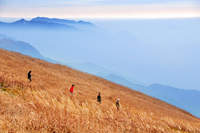
山谷中出现连绵不断的村落,在阳光的照射下,秋天的树叶呈现出迷人的金黄色。路边开始出现穿着漂亮民族服装的Kalasha 姑娘,她们不用头巾蒙脸,也不回避陌生人,不像穆斯林女人那样遇到外人就远远地躲开,看见相机更是如同惊弓之鸟一般散开。我大喊道:“Run, Forrest. Just run as fast as you can.”(引自电影《阿甘正传》,我扮演Jenny的角色,在为奔跑的阿甘们加油。)
Bumboret包括首尾相连的四个村子,Anish, Brun, Batrik和Krakal。我在第三个村子Batrik下车,放下背包马上去寻找拍摄目标,一个持枪警察紧随我身后。一个Kalasha姑娘在玉米地里干活,我走过去,拿出相簿给她看中国的照片。姑娘显得很害羞,但并不回避我。走到一座桥上,对面来了四个穿着传统衣服的小姑娘,她们围过来看我的相簿,唧唧喳喳的。
沿着山路上行,我来到第四个村子Krakal。这里的人更多,村子中间还有一个小广场,孩子们在做游戏。警察带我走进一个家庭,女主人坐在火炉前烤面饼,这类似于怒江峡谷中怒族人的做饭方法。我一直有种感觉,Hushe Valley和Kalasha Valley的居民似乎跟藏人有着一种文化上的联系……
Who pays for the bill of security guards?
我们住在Peace Hotel,
去年,一个希腊人在Kalasha Valley被劫持,塔利班向巴政府索要五百万卢比的赎金,交易地点在巴军方势力范围之外的阿富汗境内。西方人在巴境内被劫持,有损于巴基斯坦政府的形象。所以,他们对外国人实行24小时跟踪保护。今晚,我的身旁睡着三把冲锋枪。如果哪个不知趣的试图劫持人质的话,他可要倒霉了。
“Where is the Taliban? I ain’t seen nothing yet.” I was kidding.
“There dare not come.”
“We have three submachine guns. Anybody trying to break into the house shall die.”
次日7am,我们搭乘一辆丰田吉普车返回Chitral。在Brun搭上一家五口,其中一个披着白色头巾的女子显得高贵而美丽,完全不同于那些衣着简陋的村姑。这么偏僻的村子藏着这么美丽的人,或许她们一家人是来此度假的?后来听说巴北部山区居住着很多伊斯马利人(Ismailism,穆斯林什叶派的第二大分支),他们虔诚且爱好和平,普遍文化程度较高也较为富足。我碰到的有可能是当地贵族的后裔。皇权被废除后政府会给他们一些补偿,他们从此过着普通人的生活,但是拥有足够的财富给孩子提供好的教育。
看到车里坐着一个外国人和三个警察,她注视了我一眼,马上低头上车——她那美丽的眼神让我有一种触电的感觉。很多穆斯林女子是很漂亮的,可惜她们将美丽藏在头巾之下,不肯示人。她们很少接触男人,按照宝玉的说法,身上也就没有沾染上男人的污浊气,因此穆斯林女子天生有一种纯洁的美。


羡慕你,戴头巾的姑娘。
你灵动万千,娥眉婉转。
一块普通而廉价的方巾却赋予你一种高贵而纯净的美。
还是羡慕你,戴头巾的姑娘。
你衣袂蹁跹,身姿卓然。
那仅是一件朴素的布衣啊,为何如此这般的卓荦绝俗?
真的羡慕你,戴头巾的姑娘!
你静若闲花,暗吐幽香。
那是一种什么样的美啊:
在这红绿灯的街口,
在每一张麻木的脸上,
在所有焦躁不安的灵魂里,
所有的华服和虚伪的装束都已黯淡。
而你,一个美丽的转身,成为我心中的一抹绿。
travelogue
·
2011-04-24 11:44
[Mar 21, 2011, Pokhara] Great news from Annapurna! I have completed Annapurna Circuit Trek (ACT) within 10 grueling days, starting from Besisahar at 14:20 on Mar 10, ending at Tatopani at 12:00 on Mar 20, 2011. Total time:10days; total distance: 183km; highest elevation: 5500m.
Annapurna Circuit Trek has been the longest and the highest trek I have ever taken. Without mountain guide/porter and trekking partners, I was taking on Annapurna alone, carrying two backpacks around 15kg. On Day 8, I summit the highest mountain pass, roughly 5,500m, of my life. Due to the fact that I have carried US Army food supplies for seven days, the trekking campaign was completed with a limited budget of 4,500 rupees, in addition to the 2,000-rupee trekking permit.
I always believe that, on those who have returned from snow peaks, you could see the light of God. When Moses, the Jewish prophet of Exodus, brought back the stone tablet of Ten Commandments, the people of Israel have seen the light of God on his face!
YOU CAN
BECAUSE
YOU THINK YOU CAN
Annapurna Circuit
This circuit was once considered one of the best treks in the world though road construction is threatening its reputation and its future as a classic trek. Yet no one disputes that the scenery is outstanding: 17 to 21 days long, this trek takes you through distinct regional scenery of rivers, flora, fauna and above all - mountains.
There are four regions that are passed through on the trek; Lamjung, Manang, Mustang and Myagdi. Lamjung and Myagdi of the lower elevations are both predominantly Hindu and with lush green subtropical valleys with villages and terraced farming.
Manang and Mustang are of the higher elevations and are predominantly Tibetan Buddhist. The Manang people are Gurung (not Tibetan descent) and are very proud of their unique cultural heritage and merging of lower land Gurung and Tibetan cultural influences. People of Mustang identify themselves a lot closer with Tibet and the Mustang region has actually been part of Tibet in history. Mustang also is one of the last places in the world to view the ancient Bonpo Religion in action. Villages to note for Bonpo are Thini and Lupra near Jomsom, and Nargon near Kobang.
The trek goes counter-clockwise from Besisahar to Nayapul and reaches its summit in Thorung La (pass) at the height of 5416m, or 17,769 feet. The route goes past the following mountains: Manaslu (an 8,000-plus meter peak), Langtang Himal, Annapurna II and IV, Annapurna III and Gangapurna, and, of course, Annapurna I and Dhaulagiri -- passing through the world's deepest gorge in between those two 8,000-plus meter peaks. Poon Hill, at the end of the trek, affords views of those two mountains, as well as South Annapurna and Macchupucchre, the "Fishtail Mountain."
The trek also goes through Buddhist villages and Hindu holy sites, most notably the village of Muktinath, a holy site for both Buddhists and Hindus, and Braga, one of the oldest monasteries in the region.
The eastern portion of the trek follows the Marsyangdi River upstream, to its source near the village of Manang. To get there several days of up-hill hiking are required. Then the route goes over the pass, a grueling day of hiking, and back down the other side, where it meets up with the Kali Gandaki River. At the end of the trek, several options are available: following the river further to the road proper to Beni and catching a bus to Pokhara, or adding on a trek to the Annapurna Base Camp (ABC Trek), aka the Annapurna Sanctuary Trek.
This is a "teahouse trek," meaning there are villages with lodges and restaurants to eat and stay in along the entire route. You are expected to eat breakfast and dinner in the same lodge where you are spending the night. Prices of rooms are seemingly inexpensive because of this (100-300Rs for a double) - lodge owners tend to make more money on the food and drinks they are selling you than on the room where you are sleeping.
Courtesy of Wikitravel, the Free Travel Guide
travelogue
·
2011-04-27 08:24
The Himalaya are a range of mountains in Asia, most correctly defined as stretching from the Indus river in Pakistan, through India, Nepal, Bhutan, ending at the Bramaputra River in India. This is often extended to include the Karakoram, the Hindu Kush, and other minor ranges extending from the Pamir Knot, as these mountains are continuous with the Himalaya proper, and the geographical difference makes no difference for the traveller, we follow this convention here. This region includes the 14 highest mountains in the world, and over 100 peaks over 7200m.
The Himalaya are a home to a diverse number of people, languages, and religions. Generally speaking Islam is prevalent in the west, Hinduism in the southern ranges of the eastern Himalaya, and Buddhism in the northern ranges of the western Himalaya. While there are numerous languages spoken, Hindi/Urdu (when written, they are two totally different languages, when spoken they are nearly interchangeable) will take you very far, as it is understood by the majority in the Pakistani, and Indian Himalaya. In Nepal it's not very useful, but it does have significant overlap with Nepali, and as such gives you a head start with that language.
Day 1
On March 10, 2011, I started the long-awaited expedition to Annapurna Circuit Trek (ACT). I brought with me two backpacks, weighing around 15kg. The big one is for outdoor wears for winter and the small one is for food. US Army food supplies were carried all the way from Peshawar. Now, it's time to spend them. Unused items were packed in three small bags, including a lady's bag left by my sister. Due to miscommunication with my hotel, I had to pay Rs. 100 to save my luggage at a bike rental shop.
The bus is leaving at 8:30am from the Main Bus Park. Again, I was the only trekker taking public transportation (Rs. 190) to Besi Sahar, the starting point of ACT. Locals filled in quickly. Fishtail peak can be seen clearly from Pokhara. No wonder March-April is the second best season of the year.
Road condition in Nepal improved a lot, cutting travel time by one third. At 1pm, I arrived at Besi Sahar, a busy town filled with foreign tourists. I ordered as much food as I could eat, Rs. 50 for chowmein, Rs. 70 for momo. This is the cheapest place to eat before heading into Himalayas. I also bought five instant noodles and some biscuits. Not enough, but I could only carry as much.
At 14:00, I took the shuttle bus to Bhulbhule. Foreigners were charged for Rs. 200, twice as much as the local price. I was advised by Russian trekker to take the bus. It worth it because road was dusty. Plus, it could save me 3 hours or 9km in walking.
16:00, the bus arrived at Bhulbhule (840m), where I encountered the first ACAP check post. Trekking formally started from here. It's late in the afternoon, not many trekkers were there. There was a suspension bridge across the river. The river was very clear in Spring time.
17:00, I reached a wide open field, where farmers and cows were plowing seeds. The second village is Ngadi (890m), and the third village Bahundanda (1310m) is two hours away. Despite warnings against walking after dark, I continued.
18:00, I was confused by a river crossing. A new road was being built here, and I could see jeep tracks clearly. I decided to cross the river because the new road was really good. It was later proved to the wrong way, but it's the shortcut. Follow your common sense, not the guide!
19:30, I saw a village on the hilltop on east side of river. That was Bahundanda (1310m). Locals said that there was a 200m ascent followed by another 200m descent to Ghermu (1130m). It's a waste of elevation and time. I decided not to cross the river and continued on the new road. Walking under moonlight is enjoyable, I could avoid heat and sunburn during the daytime. Only thing that bothers me was the heavy load on shoulder. I ate two chocolates during the break.
21:00, I was walking under headlight and road condition was really good. After a long period of darkness, there was the light! It's a new settlement catering for the passengers. Room conditions were just so so. I was told that Syanje was 30 minutes away. Oh my goodness, I just realized that I had passed two villages after Ngadi, completing two-day trekking in just one day. It's to try hard at the beginning, which would make things easier in the future.
22:00, I finally reached Syanje (1100m). All hotels and restaurants were closed. I had to knock hard to wake up the owner of Waterfall Lodge. The rooms were basically empty, I bargained for Rs. 100. I did not have dinner since I ate a lot today.
Day 2
After a good night of sleep,I did not wake up until 10am. I walked across the bridge to Ghermu, and saw the old trekking trail. Yesterday, I took the “wrong way” which is not listed on map, but it's the shortcut. The jeep driver told me that a ride from Besisahar to Sangje costed Rs. 500, which could save 22km and 7h in trekking. It's highly recommended for trekkers because the scenery at low altitude is boring. Once the new road is completed, villages before Sangje will lose business.
13:00, temperature 28C, humidity 30%. The trek started with a steep ascent. To save distance, I climbed straight up via shortcuts. This might be the steepest trek I would take in Annapurna. It's impossible to do it at a higher altitude. A team of caravan were carrying cargo to Manang.
14:30, I arrived at Jagat (1300m). Many people stayed here for tonight. I met the French team who warned me not to continue after dark. They were really slow.
15:50, Chamche (1385m) is a large town on ACT. I met a young British couple who started trekking on the same day as I did. They walked really fast because they did not take bus. Due to road construction, there were bomb blasts from time to time. We were waiting behind a local hotel for clearance. There was a deep descent into river valley, followed by a river crossing on a temporary wooden bridge. From here, road construction and engineering vehicles on the opposite riverbank can be clearly seen. Big stones are falling down to the river.
19:00, This was a long trek, many ups and downs, trekking trails were murky after dark. I used headlight to direct the British couple to climb. Eventually, we arrived at Tal (1700m). I checked in Garden Hotel (Rs. 50).
Day 3
10:00, temperature 14C, humidity 55%. I ordered one milk and opened a raspberry cookie.
13:00, Dharapani (1900m), temperature 20C, humidity 40%. The second ACAP check post is located here. According to the checklist, Pipi and her friend had passed here five days ago. I saved one day time. Not many Chinese trekkers took this trek.
15:00, Danagyu seemed like a Tibetan village. I met Loic, a tough French trekker carrying a huge backpack from Kathmandu. Instead of saving his luggage in Pokhara, he's determined to carry everything up to mountain pass at 5400m.
16:00, tree line appeared above 2000m level. There was a steep ascent of two hours leading to Temang. It is the most difficult part so far. Loic never stopped climbing, which, in his words, is a training for his heart. I felt far behind of him.
17:45 - 18:30, Thanchowk (2570m), temperature 10C, humidity 60%. I met an Iranian girl sitting outside the village. It's very rare to see Iranians outside of Iran, let alone a female traveler. According to Chinese girl travelers, Iranians were so shocked to see female travelers carrying a big backpack. I followed her to a Tibetan family hotel (Rs. 50), where she spent night with three Israeli travelers. When asked about the Iranian nuclear issue, they said that they want to reach a peaceful resolution, not by bombing the Iranian nuclear reactor. It's interesting to see travelers from enemy countries were traveling together.
Day 4
9:00, the Tibetan family did not have small changes, so I paid room charge with 2 teabags, 2 Maxwell coffee and creamers, 2 Postan painkillers, plus one picture of Dalai Lama as gift. They could easily sell for Rs. 200 for other tourists. I realized that my food and drink supplies, especially medicine, worth a lot in the isolated village. This was proved even true at a higher altitude.
9:40, a quick descent to Koto (2640m), a small village surrounded by snow peaks. There were Tibetan prayer flags and prayer wheels in the village. This was part of Tibet in ancient times.
10:20 - 10:50, Chame (2710m), a big village for rest. I talked with an Australian couple for half an hour. They were retired dentist and wanted to find employment in China. I that English-speaking dentists are highly paid by private dental clinic in Beijing or Shanghai because there were many Fortune 500 executives in need of dental surgery.
13:00, Ghratang (2850m). There is a long flat trekking trail in the virgin forest. The river was clear and blue, just like Western Sichuan of Southwestern China. It's probably one of the best looking parts of ACT.
13:40, snow line appeared above 3000m level.
14:50, Dhukur Pokhari (3240m), temperature 14C, humidity 50%. Pasture appeared on an open flat highland, very similar to Four Girls Mountain of Western Sichuan. There was plenty of sunshine, with warm wind blowing up from Indian Ocean. There was a river crossing outside of the village, where the trekking trail was split into two. I believed that one trail led to Lower Pisang (3250m), the other trail led to Upper Pisang (3310m). The porters told me to cross the river, but this was later proved not exactly right. I was led to Lower Pisang, and had to climb to Upper Pisang.
16:00 – 16:30, Lower Pisang (3250m). This is a totally Tibetan village. I could see that Upper Pisang (3310m) was right on the opposite side of river. There was a very steep ascent for 30 min. Completing the last leg above 3000m was not easy.
17:00, I reached to the top of village, where rooms were cheaper and free hot water was provided. I also recharged my camera battery. I ordered and cooked, for the first time, a fried rice for Rs. 200. The old lady also made Tibetan butter tea for me. It was very warm in the kitchen, with lots of burning firewood. Room temperature dropped to 7C at night. I was reading a banned book entitled “Chinese Scholars On Tibetan Issues” published by Tibetan Government in Exile.
Day 5
6:30, temperature -2C, humidity 60%. Sunrise on Annapurna IV (7535m). Upper Pisang has a much better view than Lower Pisang, the high path is highly recommended by trekkers. There was a Tibetan Buddhism temple in the village, recently rebuilt from ruins.
8:00, After a steep descent to river, I turned right to Ghyaru at ACAP road sign. After 20 min of trekking, a beautiful lake of jade color appeared out of nowhere. I stopped to take some pictures. No wonder the high path is more beautiful.
9:00, After a steep ascent of 400m to Ghyaru (3730m), three snow peaks can be clearly seen from the high path: Lamjung Himal (6983m), Annapurna II (7937m) and Annapurna IV (7525m). The higher I went, the bigger Annapurna II became, shadowing the lower peaks in the front. The scene will be seen on the lower path.
11:00, Ghyaru (3730m), nobody can be seen in the village. Treeline disappeared, low bushes and desert land showed up.
12:00, I reached the highest pass (3800m) for today. There were no forest cover any more. The sunshine was quite strong, I applied sunscreen and pulled up sunglasses for the first time.
13:30, Ngawal (3680m). During lunch break, I met a young Australian couple, who, like Loic, carried out some sort of training. They were fully equipped, fully loaded, and carried food supplies, cookeries and oven, sleeping bag and camp.
14:15, we continued on the high path for 2 hours. The awesome duo never stopped for break until they reached the next village. They walked with such a military marching pace that only enemies' fire could stop them. I tried to follow them for an hour before they deserted me.
16:00, there was a steep descent to an open pasture. Trekking trails were murky and it's easy to lost track. Humde (3330m) was nowhere to be seen. It might be on the opposite of river. The next village turned out to be Mungi (3400m), where high path and low path joined. Loic came out from the pasture, he lost his way after descending from high path.
16:30, I arrived in Bhraga (3450m), bypassing Humde. For the sake of acclimation, Loic wanted to go to Kecho Lake (4600m). It would have costed one day, but I'm used to high altitude already. The pass (3800m) I crossed today was actually higher than Manang (3540m). I planned to cross mountain pass in the next two days before running out food supplies. Crossing Thorung La (5416m) in 7 days is an ambitious plan, however, my Russian roommate in Pokhara just completed ACT in 7 days.
17:00, Manang (3540m) is a gathering place for trekkers, with many facilities (including a hospital for altitude sickness treatment) available. It's also the starting point for Tilicho Lake (5200m) trek. Many trekkers stayed here for 1-2 days for acclimation, which makes Manang more popular. For the same token, many trekkers decided to scale back trekking plan due to altitude sickness. I checked in Moonlight Hotel (Rs. 50), where I met an experienced Nepali mountain guide. We talked about Tibet issues for 2 hours, by which he was impressed so much. Most people, either Chinese or Westerners, had little knowledge of the history of Tibet, which made discussions meaningless.
Day 6
8:30, room temperature is 8C, even warmer than Upper Pisang. The glacier river from Tilicho Lake (5200m) joined main river near Manang. The beautiful glacier lake must be frozen in March, I therefore decided not to take side trip, which would cost another two days. Diehard Aussie couple said that they would continue to the frozen lake no matter what. There was a biking race on the trekking route. The bikers left Kathmandu and would reach Low Camp today.
10:00, Gongsang (3900m), temperature 10C, humidity 20%. I met an old Aussie couple, it's the second time they took on ACT. Many trekkers took break here, a nice view of snow peaks. I asked people to take a picture of myself. There was a long flat trekking route ahead, very very muddy because the bicycles ruined the road.
12:30 – 13:00, Yak Kharka (4050m). Many trekkers stopped here for today, while I continued ascending after a 30-min break. This was a difficult trek, a 150m rise in one hour.
14:00, Letdar (4200m) is a small village. I thought the Low Camp was within reach. However, trekking above 4000m proved to be more difficult due to lack of oxygen. The wind along the river valley was so strong that I covered myself with The North Face outdoor wear. I stopped for breaks many times. I also felt a little headache, so I took one tablet of aspirin.
16:00, I reached a road split, where there was a sign “Way to Thorung La”. There was a steep descent to river valley, followed by a steep ascent. The slope was as steep as 45 degree, the most difficult part of today. It's getting dark and I was running out of power, taking breaks every 5-10 minutes.
17:30, Thorang Phedi, aka Low Camp (4450m). Eventually, it took me3.5 hours to complete the 2.5-hour trek. I completed 900 meters climbing at 4000m level. What an accomplishment! But I was not sure about tomorrow. Could I complete another 950 meters climbing at 5000m level?
18:00, the Low Camp was so well furnished, 24/7 electricity and hot water. There were no villages here other than two hotels. The bikers were all here. Tomorrow, they will carry their bicycles across the mountain pass. I was so hungry today, and ate everything I could find on the table. I opened a pack of chicken breast and Mexican tortillas. For the second time, I also ordered potato curry (Rs. 180). Before summit mountain pass on the next day, I shall be completely full.
Day 7
9:00, room temperature -2C, humidity 25%. The water was frozen in the bottle. I woke up so late that everybody were gone! The bikers left as early as 6am. It may take 4 hours to reach the mountain pass. Indeed, I will be taking Thorung La SOLO!
9:30, there was a steep ascending of 400 meters to the High Camp (4850m). I met a French couple starting from Letkar today. They were as fully equipped as the Aussie couple, and quite experience in trekking in French Alps. They decided to stay at High Camp.
11:30, High Camp (4850m). It took me 2 hours to complete the 45 min trek. I felt frustrated. If I could not reach the mountain pass in the next three hours, it would be too late to summit. Although missing the time window would not pose a serious threat at 5500 meter level, I just did not want to go alone. I already reached the High Camp at record-breaking speed. What else do I want accomplish? After 30 minutes of pondering, I decided not to summit Thorung La today.
14:00, 10+ trekkers arrived. It's nice and warm to stay in the dining room with big windows and unlimited sunshine. I order my first lunch, plain rice, today, plus a pack of boneless pork and Shangri-La tomato ketchup made in Pakistan – I ran out of US Army food supplies. Some were reading, some were sleeping, such a cosy place at near 5000 meter level. On the bookshelf, I even found a Chinese book on Russell, the greatest British philosopher of 20th century. His famous piece “Why am I not a Christian?” is my favorite.
17:00, the sun was gone and the dining room turned cold immediately. Everybody moved to the other room where there was a big oven. There was a Korean girl, very polite and was smiling at everybody. She's trekking alone with a porter; an retired old man of 66 years old just back from the Langtang trek; a group of Israeli soldiers just finished their mandatory three-year military service. It's like a meeting of United Nations.
It's the highest altitude (4850m) that I slept at. Room temperature was near zero degree. Just make sure no headache. My heartbeat reached 92 times per second, really fast.
travelogue
·
2011-04-29 07:21
Day 8
6:30, room temperature -2C, humidity 30%. Again, everybody were gone. I was the last one to leave. The trekkers from Low Camp, who started night trekking at 4am, were already here. I did not take any breakfast, and ran into the snow land. I felt so much better today. No headache either.
7:30, there was a small tea house before the summit. The slope was gentle, but altitude was high. Every step was a hard step. Every step was a step closer to the summit. The only sound I could hear were my breath and heartbeat. I recalled the BBS post by Qingyi, “Breath on the Ice Peaks”. With the strength of an athlete and the romance of a poet, Qingyi has summit Muztagh (7546m), Cho Oyu (8201m) and Everest (8848m) receptively, and completed his travelogue in poems!
Muztagh Ata lies just south of Kongur Tagh, the highest peak of the Kunlun Shan. Together they form a somewhat isolated group, separated from the main chain of the Kunlun, and also separate from the Pamir Mountains to the west. (Both peaks are sometimes regarded as being in the "Chinese Pamir", and are more closely connected to the main Pamir group than the main Kunlun group.) Not far to the north and east of this group are the lowlands of the Tarim Basin and the Taklamakan Desert. The Karakoram Highway passes very close to both peaks as well as Karakul Lake, from which the mountain is conveniently viewed. The closest city is to the mountain is Tashkurgan, the westernmost town in China and very close to the border with Pakistan.
The Swedish explorer and geographer Sven Hedin made the first recorded attempt to climb Muztagh Ata, in 1894. Additional attempts were made in 1900, 1904 and 1947, the last by the team of Eric Shipton and Bill Tilman who came very close to the summit but were turned back due to cold and deep snow. The first ascent of the peak was in 1956 by a large party of Chinese and Russian climbers, via the west ridge, which is now the standard route. Since the first ascent, many ascents of Muztagh Ata have been made. In 1980, a party led by Ned Gillette made a ski ascent/descent of the standard route, the first ski ascent of a mountain over 7,500 m (24,600 ft). An ascent of the much harder south-east ridge was made in 2000, and a secondary route at the west side of the mountain was first climbed in the summer of 2005.
Cho Oyu is the sixth highest mountain in the world at 8201 meters above sea level. Cho Oyu lies in the Himalayas and is 20 km west of Mount Everest, at the border between China and Nepal. Cho Oyu means "Turquoise Goddess" in Tibetan.
Cho Oyu was first attempted in 1952 by an expedition organized and financed by the Joint Himalayan Committee of Great Britain as preparation for an attempt on Mount Everest the following year. The expedition was led by Eric Shipton and included Edmund Hillary & Tom Bourdillon, but technical difficulties at an ice cliff above 6,650 m (21,820 ft) proved beyond their abilities. The mountain was first climbed on October 19, 1954, via the north-west ridge by Herbert Tichy, Joseph Jöchler and Sherpa Pasang Dawa Lama of an Austrian expedition. Cho Oyu was the fifth 8000 meter peak to be climbed, after Annapurna in June 1950, Mount Everest in May 1953, Nanga Parbat in July 1953 and K2 in July 1954.
Just a few kilometers west of Cho Oyu is Nangpa La (5,716m/18,753 ft), a glaciated pass that serves as the main trading route between the Tibetans and the Khumbu's Sherpas. Due to its proximity to this pass and the generally moderate slopes of the standard northwest ridge route, some climbers consider Cho Oyu to be the easiest 8,000 metre peak to climb, and it is a popular objective for professionally guided parties.
Courtesy of Wikipedia, the Free Encyclopedia
Behind sunglasses, I could see nothing but a white empty world. My iPod was playing the electronic music by Kitaro, Japanese music master. Surrounded by endless emptiness and unlimited sunshine in the no-man's land, I felt so close to the Nature. This was the moment that you just can't help crying.
Why am I here? – To know myself and my Creator.
9:30 – 10:00, Thorung La (5416m). I was rushing to the end at an unprecedented speed. Everybody were celebrating here. I saw so many familiar faces, including the German blonde whom I met at Manang. She's actually tall and strong, but she was afraid of altitude sickness and demanded acclimation step by step. “The only thing you have to fear is fear itself.” that's my message to her. We took pictures of each other in front of the stone tablet. I carried with me a German flag bought in Pakistan. (No Chinese flag are available though.) I climbed up a small hill nearby the mountain pass. “This is 5,500 meter level. ” I told other trekkers. “Come on. It's just a number.”
11:00, I descent into an open mountain valley with a team of Austrian trekkers. This was a steep snow slope, which made trekking without mountain stick quite difficult. For many, descending proved to be more difficult than ascending. For me, it's just a piece of cake. I was kind of running downhill. The Austrian team were even skiing downhill.
12:00, we encountered the steepest slope of today, broken stones covered by ice. This is the last challenge after mountain pass. I now understood why it's virtually impossible for trekkers to go clockwise around Annapurna. If you want to try, this slope would end your expedition.
12:45, the snowline is over. I met the first trekker going clockwise. He's a strong man, but I warned him that it took me three hours to go down, so it would take him at least 4-5 hours to go up. It's not impossible, but very difficult to cross the mountain pass. Around the corner, I saw the next village. “That's the news we want to hear!” a British man said. The last leg of trek was really muddy. Many trekkers fell into mud, which was embarrassing. I would rather fall on the snow or ice than mud. So I stayed away from the trekking trail.
13:15 – 14:00, Charabu (4230m). Many trekkers have arrived, their body covered with mud. The weather was nice, I opened a pack of Real mango nectar. Drinking fruit juice at 4000 meter level is a luxury, isn't it?
15:00, Muktinath (3800m). The Tibetan village was situated in a huge mountain valley, with adjacent villages and Buddhist temples in sight. I checked in Bob Marley Hotel (Rs. 50), the best one in town. The hotel guy offered an offer that nobody could resist. Room rent was basically free if your eat there. The hotel was well furnished with wooden floor, clean bedsheets, Western music bar, and 24h hot shower. I was the first one rushing into the shower room. I had not taken shower for one week. Everybody need a hot shower after the summit. So there was a long queue waiting outside. The Austrian team was second, then the Korean girl, then the Israelis. The German blonde was really beautiful after she undressed outdoor wear. There was a party outside the shower room.
16:00, I took a walk around town. More trekkers have arrived, including the old Aussie couple. We would go trekking together next day. The road construction was nearly complete, and there was jeep going to Jomsom for Rs. 600. Tourism was booming in Muktinath. There was a police check post.
Day 9
8:00, I had breakfast with fellow trekkers. It's a relax morning after a grueling climbing yesterday.
10:00, I departed for a Saga Temple in town. It's interesting to see so many Saga temples in Nepal, while I saw only the main Saga Temple in Tibet.
11:20, Jharkot (3550m). I descent on a steep trekking trail to Jharkot, did not walk on the dusty jeep road. The Saga Temple in village is 550 years old.
12:15, it's kind of difficult to find trekking trails in the field. The dusty jeep road was so obvious that everybody were walking on it. I went straight down and finally found a trail along the water canal leading to Khinga (3355m). It later overlaps with jeep road.
13:15, I met a Dutch trekker and the old Aussie couple. We went together to Kagbeni, again, on jeep road. Walking on such hard road really hurt lower legs badly. After a 1000 meters descent, I felt muscle pain on the ninth day of trekking. If my knees failed, like last time when I took Annapurna Base Camp trek, I would had a miserable time going down. I decided to take bus at Jomsom tomorrow.
15:00 – 17:00, Kagbeni (2800m) is beautifully situated on the convergence of two rivers. There were large piece of land, peach flowers and pear flowers were blooming, just like Luntze of Tibet. It's one of the best looking villages on ACT, therefore many trekkers stayed here. I took a lunch break at a local restaurant and cooked for myself. I found the third Saga Temple for today. Why is that? Maybe the Saga School was pushed into Nepal by the late Gelu School of Tibetan Buddhism. I left lamas with picture of Dalai Lama and US President.
18:00, I quickly passed Eklebhatti (2740m), a small village of only four hotels. It's getting dark already, but I still wanted to reach Jomsom tonight. There was a wide open river valley between the mountains, and I walked on the dried riverbed. The wind along the river valley was very strong. Plus, my lower legs were hit badly by the round-shaped stones. The moon was really bright and hanging above the snow peaks. Other than that, this was a long boring walk under the moonlight. I could see the lights from Jomsom far away.
19:30, Jomsom (2720m) was a large town with paved stone roads! Thanks to tourism industry, Jomsom has become one of the richest villages in Nepal. There was night life here. Unlike other poor villages, students enjoyed British education at boarding school. No need for donation for building schools. All of a sudden, some wild dogs jumped out of nowhere and started barking furiously. With mountain stick by hands, I was not afraid of dogs, wild or domesticated, at all. The more you are afraid of them, the crazier they would become. I threw stones at the dogs, but they dodged away. So I continued. At the first sight of another dog afar, I hit him from 50 meters away! This is learned from Tibetan nomads.
I could find few hotels in town, but was told to go to Jomsom Airport. This was such a touristy place that only hotels and restaurants were there. I hated to see so many tourists, not trekkers, there. The best place to meet trekkers are between Manang and Muktinath, especially Low Camp and High Camp, where high altitude keeps noisy tourists away. I still missed the short time I spent with like-minded people there.
21:00, Room rent was hard to bargain here. I finally settled down at Dreamland Hotel (Rs. 200), which is the most expensive hotel on ACT. Locals were no longer innocent villagers in the Himalayas, they treat foreigners as ATM machine. No matter which religion they believe in, money has become the new religion of Jomsom people. That's the power of Western capitalism. China was changed already, Nepal will be changed as well. If one could resist the temptation of money and jump out of materialistic bondage, he would become freer and more spiritually powerful.
“Hello, my friend.” they asked.
“Sorry, I'm not your friend, but my money is.” I replied.
Day 10
8:00, I took a shuttle bus to Ghasa (Rs. 700), which could same me one day of trekking. Many trekkers were on the bus. They no longer wanted to continue on the dusty jeep road.
8:30, Marpha (2670m) is a very beautiful village surrounded by green field and peach flowers. It's just like Luntze, the Jiangnan of Tibet.
9:00 Tukuche (2590m)
9:15 Kobang (2640m)
9:30 Larjung (2550m) was a small settlement on riverbed. Treeline appeared and the scenery became more colorful and lively. Trekking trail split with jeep road after a river crossing, and again merged with jeep road after Kokhethanti (2525m).
10:10 – 10:20, Kalopani (2535m) and Lete (2535m) are two adjacent villages beautifully situated in the deeply cut river valley. This is the most beautiful part of western leg of ACT. Many young couples were enjoying their breakfast on roof-top restaurant.
11:00 – 12:00, Ghasa (2010m) is a transportation center, where many people switched bus. There was also an ACAP check post here. According to checklist, Pipi passed Ghasa three days ago, meaning I caught up three more days.
13:45, After lunch break, I detected a trekking trail carved on steep cliff on the riverbank. This is probably the only available trekking trail after road construction. The temperature rose to 25C, I had to change to summer clothes. Pairothapla was a deserted village due to new road construction. Yet, its menu, “regulated by Local Tourism Committee”, was as expensive as Jomsom's. The stubborn price monopolization of food and drinks along the trek would kill competition among hotels and force trekkers to accept whatever is available for them. If the price was not dropped, they would lose even more business after new road is opened. Therefore, I strongly oppose the price regulation.
14:15, Kopchepani (1480m). Many hotels and restaurants were closed. However, menu remain unchanged. I'm the only trekker there. I continued until a suspension bridge and reached Kabre at 3pm
15:15 – 15:30, Rupse Chhahara (1500m). The river deeply cut through mountain valley, forming a so-called “Vertical Valley”. There was a view platform for tourists down the valley. So I took some pictures there. There was a big waterfall on the road. On the opposite side sat a Rockland Hotel. I liked its location so much and decided not to continue to Tatopani, the end point of ACT.
Again, I cooked a fried rice for myself and made punch by instant drinking powder made in Turkey. Sitting on the balcony, I started reading “Selections of Russell”. Russell explains the meaning of happiness, and he is also the first Western philosopher to draw comparisons between Chinese civilization and Western civilization. Xu Zhimo was his translator during his visit to China in 1920s.
Day 11
10:00, temperature 24C, humidity 50%. There was only a two-hour walk to Tatopani. Following the road sign, there was a short trekking trail.
11:00, Dana (1400m). Many hotels were deserted. I continued trekking on dusty jeep road.
12:00, Tatopani (1200m), the end. I have completed ACT within 10 days, a record-breaking speed. I checked in Namaste Lodge (Rs. 50) near the hot spring. What a relax it would be after a 10-day trekking in the Annapurna. (It turned out that the hot spring, without sulfur smell, might be a fake one.) The business was quite good and many trekkers stopped here. There was even a bank. I started a shopping mania: Real mango nectar, coke, coconut biscuits, instant noodle, etc.
Final
8:00, temperature 15C, humidity 70%. I check the hot spring once more. Another pool was opened today so it tasted like sulfur. I postponed my trip to Beni and enjoyed the hot spring for 2 hours. There were three Russians and the girls were shy in their underwear. Even they looked 100% Caucasians, I could still set them apart from Europeans.
11:00, bus trip (Rs. 200) to Beni was a nightmare. Road was just so bumpy and dusty that all of my luggage were covered by dust! Nobody would walk on this road even they got paid 1000 rupees. I suspected that TATA bus had no suspension system because everything was jumping: bus jumping on road, passengers jumping inside bus, heart jumping in our body. Shit on Indian-made bus. Could you give me a break?
13:30, Beni (830m) is just like Besisahar. I easily found bus to Pokhara (Rs. 220). Road construction was undergoing, and we were blocked for 30 minutes. A beautiful Nepali girl was sitting beside me, so I gave her a pair of hand rings from Pakistan.
16:15 – 16:45, Lunch break at Nayapul (1070m). I came here 4 years ago, completing Annapurna Base Camp trek in 6 days. Everything remained same, no trekkers can be seen.
18:30, back to Pokhara. Take bus back to Lakeside. I bought one liter of pomegranate juice at store and ordered two fried rice at Lumbini restaurant. I may lost another 10% weight after trekking.
Travel tips:
Annapurna Circuit Trek is quite mature, with numerous lodges and restaurants along the trek. Road signs are obvious and mountain guide is absolutely unnecessary. Trekking at high altitude above 4,000m might be a bit challenging though, therefore a porter is required by many trekkers. High path after Upper Pisang is the most beautiful, and trek between Low Camp (4450m) and High Camp (4850m) is the most difficult. As such, I failed to summit Thorung La (5416m) on Day 7. Staying overnight at High Camp was also challenging, but I slept well without headache. After Muktinath (3800m), trekking trail overlaps with jeepable gravel road. Starting from Jomsom (2720m), it's unwise, if not insane, to go trekking on the dusty road. Shuttle buses are available between Jomsom (2720m), Ghasa (2010m) and Beni (830m). As road construction is threatening its future as a classic trek, trekkers are advised to go trekking between Manang (3540m) and Muktinath (3800m) only.
PS, $20 TIMS permit is avoidable if you are shrewd enough.
Difficulty analysis:
1. High elevation, mountain pass at 5416m, stay overnight at High Camp (4850m).
2. Snow-covered trek above 4000 meter in March, demanding experienced trekking skills.
3. No guide/porter, carrying two backpacks and 7 days of food supplies was a big challenge.
4. Mature trek with road signs, numerous hotels and restaurants; hard to get lost :-)
5. Overall difficulty level: 4 star
Itinerary and Budget for Annapurna Expedition
Destination Elevation/Departure/Arrival/Distance/Expense
Day 1 Sangye 1130 m 14:20 22:00 22 km Rs. 695
Day 2 Tal 1700 m 13:00 19:00 12 km Rs. 100
Day 3 Thanchowk 2570 m 10:00 17:45 16 km Rs. 55
Day 4 Upper Pisang 3310 m 09:00 16:30 21 km Rs. 250
Day 5 Manang 3540 m 08:00 17:00 19 km Rs. 200
Day 6 Low Camp 4450 m 08:30 17:30 15 km Rs. 230
Day 7 High Camp 4850 m 09:00 11:00 2 km Rs. 560
Day 8 Muktinath 3800 m 06:50 15:00 14 km Rs. 250
Day 9 Jomsom 2720 m 11:00 19:30 19 km Rs. 490
Day 10 Rupsechhahara1500 m 08:00 15:30 36 km Rs. 200
Day 11 Tatopani 1200 m 10:00 12:00 7 km Rs. 400
Beni – Pokhara 830 m Rs. 420
Acknowledgments
I would like to take this opportunity to express my gratitude to:
1. My fellow backpackers, who shared their travel stories at Chinese BBS and Lonely Planet Thorntree Forum.
2. The North Face Corp., whose pirated copy of outdoor gears were surprisingly good under the harsh conditions of the Himalayan and Karakoram Range.
3. US Army, Be All You Can Be, for their generous logistic support for trekking in Annapurna. NATO supplies are trekker tested, trekker approved and trekker recommended; Taliban fighters, who stole NATO supplies on their way to Afghanistan and sold them in the black market.
发些照片才好呀
不好意思,巴基斯坦的网络资源有限,而且天天停电。在伊斯兰堡,我要步行几公里去Serena Hotel找WiFi。由于美国使馆和五星饭店是最危险的地方,我需过三四道安检才能进入大堂。能上网发出一些文字,通知背包革命的同志我还活着,而且还在写作——这就是幸福了。汽车炸弹随时都可能在门外爆炸,俺不容易啊!
给点图让大家见识一下啊
FABULOUS STORIES ENGRAVED WITH PROFICIENT ENGLISH !
這路線20多年前已想去!
mark
:)
记号,PP太少啦
mark,好想从新疆去巴基斯坦或是中亚
楼主写得好详细。
perfact recording!