
2006年09月07日入手了Garmin 60csx,從英文版→繁體中文版→簡體中文版一路折騰過來。地圖也是如此,拼音地圖→繁體地圖→簡體地圖→自制等高線地圖。
經過多年的折騰,機器外觀和性能都日漸老化。升級換代早已提上了日程。
終於在新年中入手了它的升級版—62S,開始新一輪的折騰。這些新一代的機器功能都很強大,問題是我們如何熟練的掌控呢?
出於更加安全出行這個目的,開貼與眾人進行探討。歡迎加入,順祝大家新年快樂~
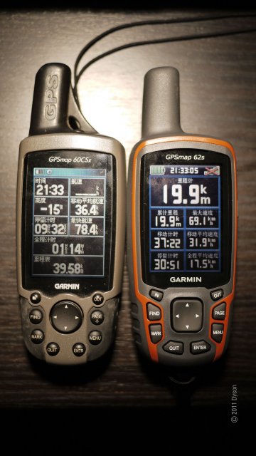
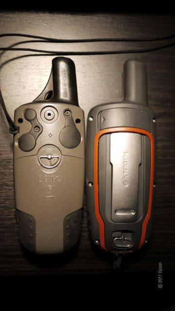
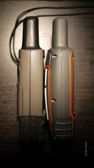
62S与60CSX外观对比:

 Dyson(丁丁)
·
2011-02-04 10:32
Dyson(丁丁)
·
2011-02-04 10:32
索引
官網:
http://www.garmin.com/garmin/cms/site/us
硬件部分
機體內容(29樓)
支持存儲卡:4GB
開機自檢(41樓)
————————————————————————————————————————————————————————
軟件部分
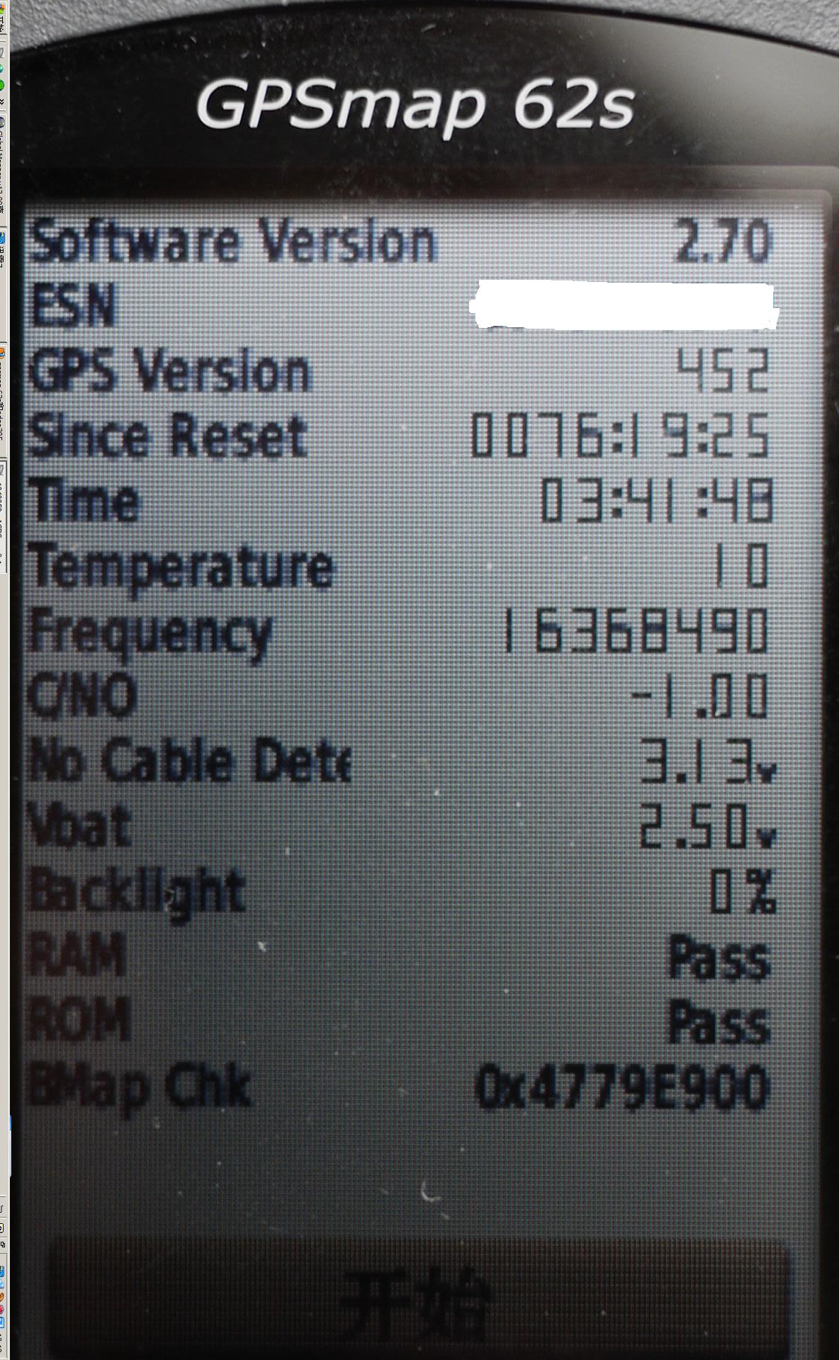
當前固件版本:2.7
界面:簡體中文,中文輸入還未解決,目前僅有字母和數字、標點符號輸入
航點管理
1)增加
2)刪除
3)在地圖上添加地點不方便,需手工輸入坐標予以更正,否則就是機器所在地點
航跡管理
1)
2)
3)
————————————————————————————————————————————————————————
[地圖部分]
CITY:大陸﹑港澳﹑臺灣地圖
TOPO:全國20M等高線地圖(40樓)﹑自制方法
DEM:DEM地圖(40樓)(可顯示,但偏移)
BLUE:海圖
照片地圖
(本帖38樓)
————————————————————————————————————————————————————————
[其他部分]
使用時間(鎳氫電池),正在測試中,開啟GPS可用20小時左右
車載使用,暫無法連接點煙器
無線傳輸,有待研究
外接設備(心率帶﹑踏頻器),有待研究
與手台連接,有待研究
Dyson(丁丁)
·
2011-02-06 01:16
幾天用下來,和60CSX相比有以下一些優缺點:
[信號]
62S爲14通道,很容易就到3M精度。而60CSX爲12通道,雖然能達到3M精度,但是很少。
[支持地圖]
60CSX能支持CITY和TOPO地圖,海圖未試過。
62S除了以上地圖外,還支持DEM地圖﹑圖片地圖(還在研究中)
[外部電力]
60CSX支持車載點煙器電力
62S目前沒發現,插入點煙器電力就顯示USB數據傳送狀態
[航點航跡管理]
60CSX增加刪除很方便,但是數量有限
62S增加方便,刪除需在電腦中進行(更好方法還在摸索中),但數量是60CSX的好幾倍
这是目前用到的一些功能,更多情况还在慢慢摸索中~~
Dyson(丁丁)
·
2011-02-10 03:11
今天開始同時測試與60CSX對比的電池使用時間(爲用了多年的2700毫安鎳氫電池)
電池省電模式:關閉
1)16小时30分钟
2)
3)
電池省電模式:開啟
1)
2)
3)
同時翻譯說明書
装了4G TF卡后成功显示全国20M等高线图
成功搞定照片导航,待贴图
目前正在下載第五種地圖:海圖!
Dyson(丁丁)
·
2011-02-12 04:26
自製照片實踐成功
原圖片:

GPS中顯示內容:

操作全過程:
Dyson(丁丁)
·
2011-02-12 05:22
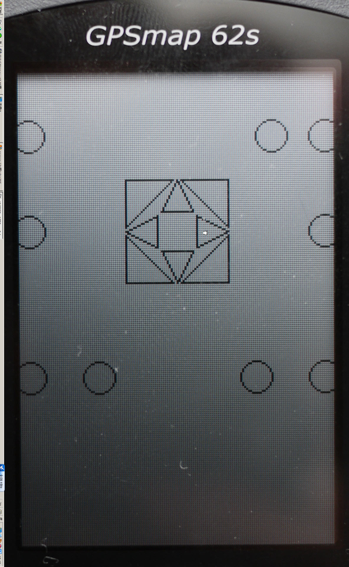
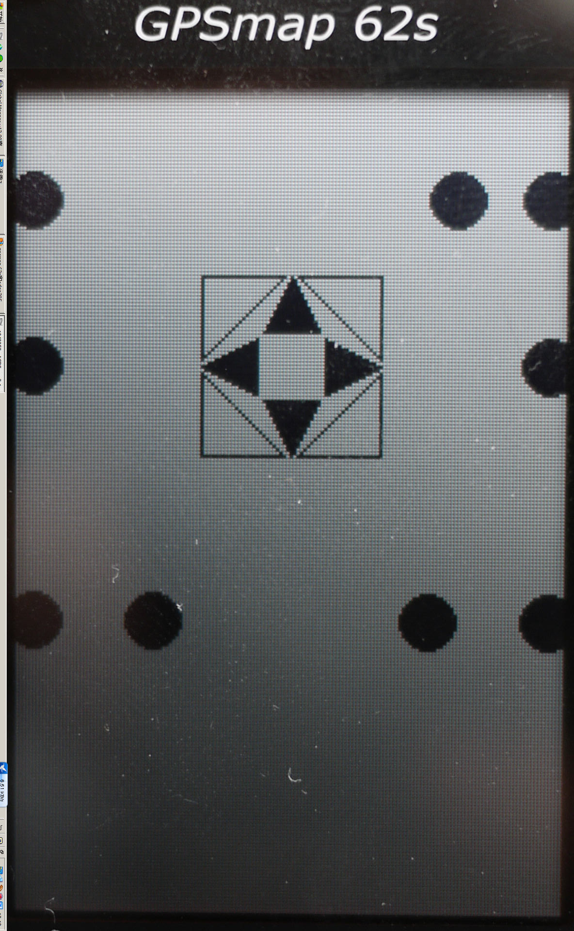
62S開機自檢:
開機後,等GARMIN的圖標出來後立刻按住“ENTER”鍵,直到下列圖案出來:

 Dyson(丁丁)
·
2011-02-14 00:53
Dyson(丁丁)
·
2011-02-14 00:53
正在測試中的鎳氫電池使用時間進程如下:
地點:家中窗台上
說明:GPS開啟,里程表和計時器清零。
數據採集:電力耗盡自動關機,換上新電池開機讀取數據。
電池:2700毫安用了多年的鎳氫電池
備註:62S和60CSX同時測試,同時測試兩台GPS在同一地點信號漂移情況,這是後面將要進行的工作
結論:根據使用經驗,測試時間長於實際使用時間,改數據僅供參考
測試中的情景:

目前結果:
62S(省電功能關閉):
1)19小時37分鐘
2)18小時31分鐘
3)16小時34分鐘
60CSX:
1)15小時33分鐘
2)15小時53分鐘
3)16小時06分鐘
62S(省電功能開啟):
1)
2)
3)
Dyson(丁丁)
·
2011-02-19 09:40
今天,把固件從2.7升級到了2.92,如圖:
目前最明顯的是原先的14通道變成了12通道,其他的暫未發現有啥改變
這是新固件的變化:
Changes made from version 2.91 to 2.92:
Fixed issues with WAAAS/EGNOS
Fixed issue with progress bar displaying properly on power up
Fixed issue with track navigation not adding waypoints to the Active Route list when they are exactly equal to a track point
Problems with the software may be reported to 62-78Beta@garmin.com
Changes made from version 2.90 to 2.91:
Updated magnetic Earth field data
Improved GPS performance
Fixed issue with track navigation sometimes not adding waypoints to the Active Route list
Fixed issue with track and route review from the map page if you came from the elevation plot
Fixed issue with MPC map labels disappearing
Fixed issue with gpi files that have alerts attached to the points
Problems with the software may be reported to 62-78Beta@garmin.com
软件2.92(测试版)
与WAAAS / EGNOS的固定的问题
修正了进度条显示电源正常注册
与轨道导航不会增加航点主动路由清单固定的问题时,恰好等于一个轨迹点
软件2.91(测试版)
地球磁场现场数据更新
改进GPS的性能
导航与跟踪固定的问题,有时不增加航点的主动路由列表
与跟踪,并从地图页面路线检讨修正问题,如果你来自海拔阴谋
固定的问题与MPC地图标签消失
用GPI固定问题有警示附加档案的各点
软件2.80
固定关断与当前曲目更新软件后发生
修正了一个坑,发生在一个单位有1000个自动命名航点
与海洋映射的不动点问题,有时不正确的符号绘制
软件2.70
增加了对支持啁啾™ 。
固定的问题具有一定的自定义地图。
固定的问题具有一定的JPEG图像。
固定的问题有视力'n跳到北部和用户参考。
软件2.60
修正问题,而使用路线规划拼写搜索。
固定问题,即曲目无法从地图上被禁用。
里程表距离与修复的问题。
修正关闭,而平移的长时间的地图。
软件2.50
时间自动晕渲地形选项。
新增显示颜色来跟踪GPX档
增加了对GPX档进口指标
新增multicaching支持
新增的定期跟踪归档
新增追踪检讨改进页
改善地图的选择。 访问径技术获取更多信息。
改进的键盘响应
高度表的读数不一致固定的问题
固定日历显示所有geocache发现与正确的日期尝试
修正了停产
登录后一个固定传呼geocache
修正关机关于页面
冠冕堂皇的固定点上显示某些地图
更新的地图和路线的轨道审查。 现在距离所示沿路线或轨道的距离。
软件2.44(测试版)
新增multicaching支持。
新增显示颜色来跟踪GPX档。
时间自动晕渲地形选项。
增加了对GPX档进口指标。
新增追踪检查页面的改进。
提高精度的旅行里程表。
修正了关闭。
固定日历显示所有geocache发现与正确的日期尝试。
登录后一个固定传呼geocache。
高度表的读数不一致修复的问题。
软件2.40
改进的显示格式,在键盘上网页上的位置。
项目位置固定的问题在使用拉脱维亚商标位置的格式。
偶尔屏幕故障时删除正在计算路线。
新增扳手接口选项,62车型。
软件2.30
新增Geocache过滤
新增为伯兹艾图像亮度调整
WAAS的性能改进
间歇性的问题有两个固定键盘输入栏出现拼写搜索
软件2.10
初始版本
Dyson(丁丁)
·
2011-04-05 14:27
固件版本有新的了:2.93
更新内容:
所做的更改从版本2.92到2.93:
•改进GPS的性能
•改进JNX文件处理
•增加支持JNX文件的最大数量从200到250
•固定关机时组已经上比JNX文件的最大数量多
•固定关断有关地形图和土地覆盖的文字大小
•固定滑降比对目标字段
•修正问题,配置文件和地图上的页面上的字段
•与软件问题可能会报告给62-78Beta@garmin.com
Dyson(丁丁)
·
2011-04-06 03:46
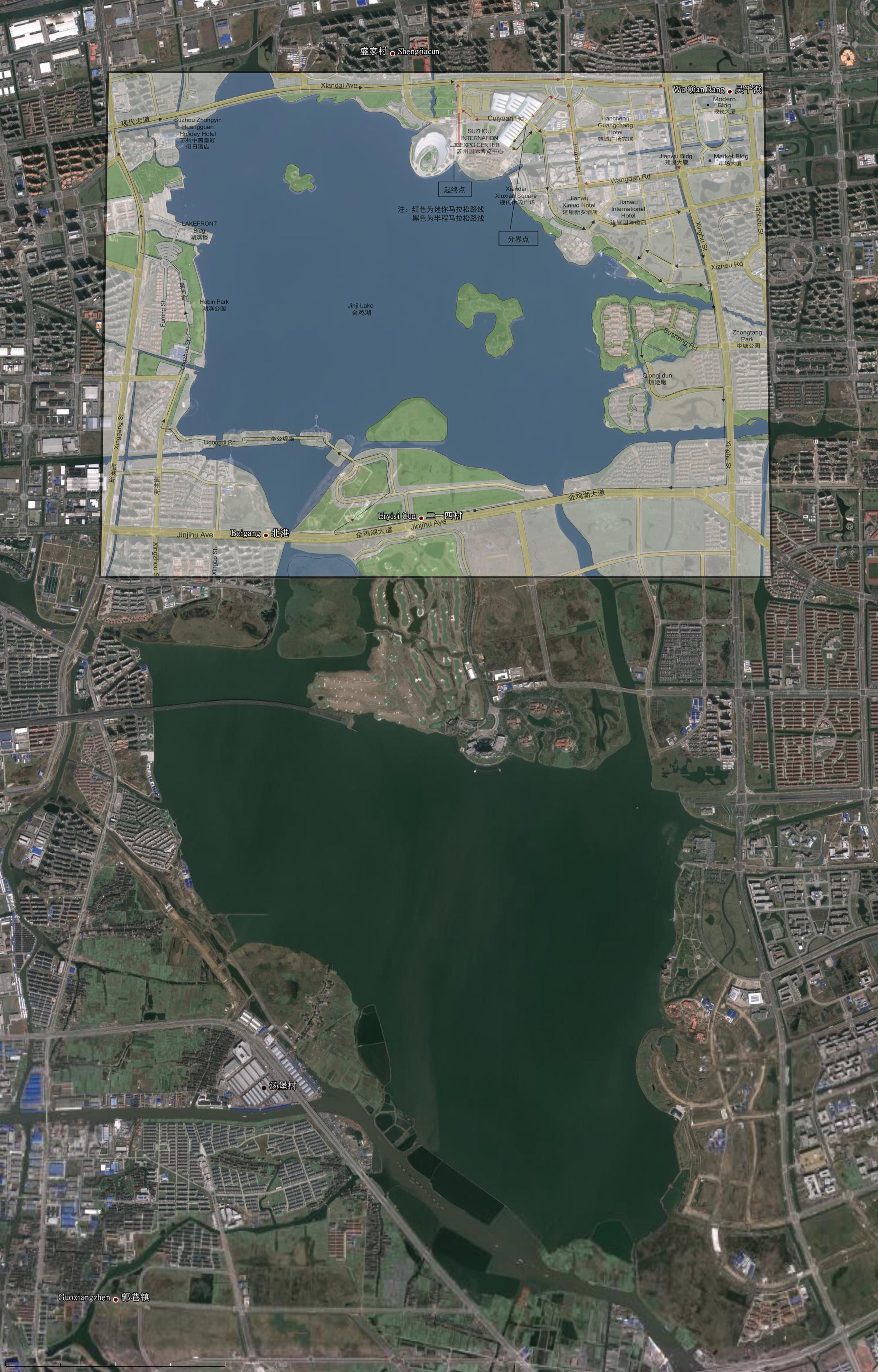
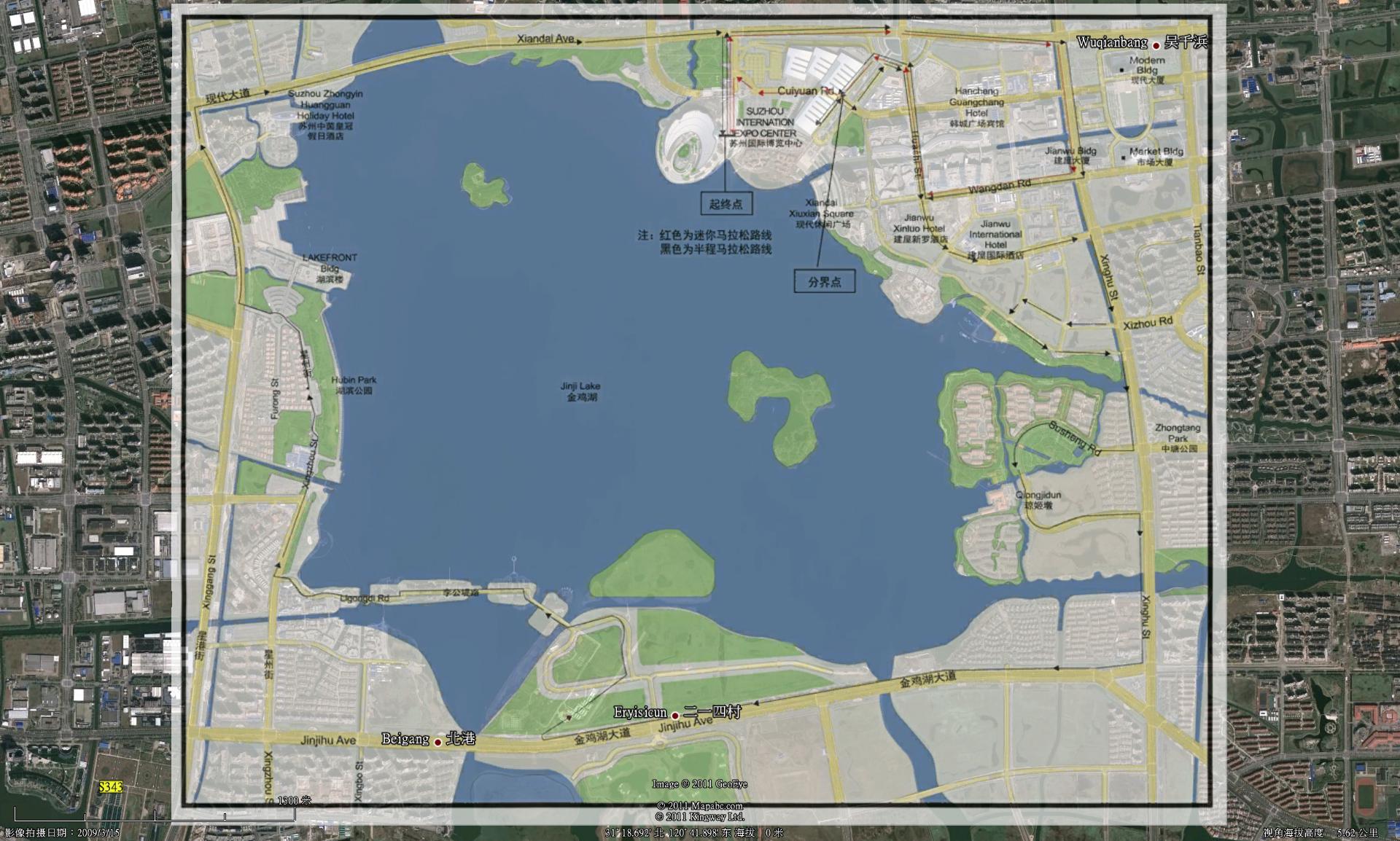
制作照片地图时发现以下问题,现在顺利解决。
如图:
旧版地图苏州马拉松照片地图
格式:JPEG
尺寸:1717×1322
大小:630.4KB

根据此图制作的照片地图预览:
下载地址:
http://filer.blogbus.com/4666469/resource_4666469_1299760851p.rar
开机后显示:不支持渐进式地图,而无法显示此地图
正好比赛线路做了微调,我也做了相应变更。
新版地图苏州马拉松照片地图
格式:PNG
尺寸:1039×810
大小:332.8KB

根据此图制作的照片地图预览:
下载地址:
http://filer.blogbus.com/4666469/resource_4666469_1299760851p.rar
Dyson(丁丁)
·
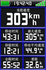
2011-04-08 08:41
刚才在动车上测试搜星良好,全程记录下轨迹,并测得最高250公哩时速,明天去高铁上再次测试
看来新的固件没让我失望
Dyson(丁丁)
·
2011-04-09 07:46
使用新固件后的62S没让我失望,刚才在高铁上全程搜星和记录正常,记录下最快时速322公哩/每小时
Dyson(丁丁)
·
2011-04-15 13:26
今天在地铁一号线地面行驶时成功的锁定卫星并记录。但是五号线却无法锁定,奇了怪了
还有,将GPS与车辆点烟器连接后,可以正常导航,并使用车辆的电力
Dyson(丁丁)
·
2011-05-05 11:30
升級了最新的2.95固件,粗看就比2.94要好。
接下去三天進行嚴酷測試,包括1500公哩左右動車組全記錄,50公哩山地越野跑等。
十天後再去飛機上進行搜星測試。
Dyson(丁丁)
·
2011-05-16 11:47
现在磁悬浮试了下,可以锁定并记录卫星。
一会去飞机上试试。
記錄下的瞬間時速:
 Dyson(丁丁)
·
2011-05-27 23:14
Dyson(丁丁)
·
2011-05-27 23:14
前天和60CSX同時升級為2011.12地圖,昨天用下來和2010.30一樣好。
Dyson(丁丁)
·
2011-05-29 13:55
改变历史
Changes made from version 2.80 to 3.00:所做的更改从版本2.80到3.00:
Updated magnetic Earth field data地球磁场现场数据更新
Improved GPS performance改进GPS的性能
Improved support for BirdsEye™ Satellite Imagery (each provider's imagery can be configured independently)改进了对伯兹艾™卫星影像(每个供应商的图像可单独配置)
Increased the maximum number of supported JNX files to 250 from 200增加了支持的JNX文件的最大数量从200到250
Fixed issues with WAAS/EGNOS与WAAS / EGNOS的固定的问题
Fixed issue with track navigation sometimes not adding waypoints to the Active Route list导航与跟踪固定的问题,有时不增加航点的主动路由列表
Fixed issue with track and route review from the map page if you came from the elevation plot与跟踪,并从地图页面路线检讨修正问题,如果你来自海拔阴谋
Fixed issue with MPC map labels disappearing固定的问题与MPC地图标签消失
Fixed issue with gpi files that have alerts attached to the points用GPI固定问题有警示附加档案的各点
Fixed issue with progress bar displaying properly on power up修正了进度条显示电源正常注册
Fixed issue with track navigation not adding waypoints to the Active Route list when they are exactly equal to a track point与轨道导航不会增加航点主动路由清单固定的问题时,恰好等于一个轨迹点
Fixed shutdown when unit had more than the maximum number of JNX files on it关机时固定装置上已经超过了JNX文件的最大数量多
Fixed shutdown related to topographical maps and land cover text size固定关断有关地形图和土地覆盖文字大小
Fixed Glide Ratio to Destination field滑降比对固定目标字段
Fixed problem with profiles and the fields on the map page固定的问题在地图上配置文件和页面上的字段
Fixed an issue with magnetic north reference and waypoint headings修正了一个问题,磁北标题参考和航点
Fixed shutdown on the map screen when a waypoint was being moved to the same location as a geocache or other POIs修正关机时屏幕上的地图被一个航点转移到为geocache同一地点或其他景点
Fixed issue where proximity waypoint alerts could only be set in feet regardless of what was selected as a Distance/Speed unit in the setup page固定问题,即接近航点警示只能设置在什么样的脚被认为是距离/速度单位设置页中选择,无论
Fixed an issue with archived tracks not displaying properly修正了存档的曲目问题,显示不正常
Fixed an issue with having too many custom symbols on the device修正了一个问题,在设备上有太多的自定义符号
Modified the 'Arriving at Destination' message banner so that it no longer appears when navigating to a geocache修改了'抵达目的地'消息横幅,使其不再出现时,导航到geocache
Changes made from version 2.70 to 2.80:所做的更改从版本2.70到2.80:
Fixed shutdown related to the current track that occurred after updating the software固定关断与当前曲目更新软件后发生
Fixed a hang that occurred when a unit had 1000 auto-named waypoints修正了一个坑,发生在一个单位有1000个自动命名航点
Fixed issue with marine map points sometimes drawing with the incorrect symbol与海洋映射的不动点问题,有时不正确的符号绘制
Changes made from version 2.60 to 2.70:所做的更改从版本2.60到2.70:
Added support for chirp™ (62s, 62st, 78s, 78sc).新增对啁啾™ (62s,62st,78s,78sc)。
Fixed problem with certain custom maps.固定的问题具有一定的自定义地图。
Fixed problem with certain JPEG images.固定的问题具有一定的JPEG图像。
Fixed issue with Sight 'N Go and user north reference (62s, 62st, 78s, 78sc).固定的问题有视力'n跳到和用户北引用(62s,62st,78s,78sc)。
Changes made from version 2.50 to 2.60:所做的更改从版本2.50到2.60:
Fixed issue while using spell search in route planner.修正问题,而使用路线规划拼写搜索。
Fixed issue where tracks could not be disabled from the map.固定问题,即曲目无法从地图上被禁用。
Fixed issues with odometer distance.里程表距离与修复的问题。
Fixed shutdown while panning the map for extended periods of time.修正关闭,而平移的长时间的地图。
Changes made from version 2.40 to 2.50:所做的更改从版本2.40到2.50:
Added Automatic Shaded Relief option.时间自动晕渲地形选项。
Added display color to track gpx files新增显示颜色来跟踪GPX档
Added import indicator for gpx files增加了对GPX档进口指标
Added multicaching support新增multicaching支持
Added periodic track archiving新增的定期跟踪归档
Added track review page improvements新增追踪检讨改进页
Improved map selection.改善地图的选择。 Visit http://garmin.blogs.com/softwareupdates/trail-tech for more information.访问http://garmin.blogs.com/softwareupdates/trail-tech获取更多信息。
Improved keyboard responsiveness改进的键盘响应
Fixed issues with inconsistent altimeter readings高度表的读数不一致固定的问题
Fixed calendar to display all geocache finds and attempts on the correct day固定日历显示所有geocache发现与正确的日期尝试
Fixed occasional shutdowns修正了停产
Fixed paging after logging a geocache登录后一个固定传呼geocache
Fixed shutdown on About Page修正关机关于页面
Fixed spot sounding display on certain maps冠冕堂皇的固定点上显示某些地图
Updated map review of tracks and routes.更新的地图和路线的轨道审查。 The distance shown is now the distance along the route or track.现在距离所示沿路线或轨道的距离。
Changes made from version 2.30 to 2.40:所做的更改从版本2.30到2.40:
Improved display of position formats on keyboard page.改进的显示格式,在键盘上网页上的位置。
Fixed problem with position entry when using Latvian TM position format.项目位置固定的问题在使用拉脱维亚商标位置的格式。
Removed occasional screen glitch when routes are being calculated.偶尔屏幕故障时删除正在计算路线。
Added Spanner interface option to 62 models.新增扳手接口选项,62车型。
Changes made from version 2.10 to 2.30:所做的更改从版本2.10到2.30:
Added Geocache Filtering新增Geocache过滤
Added brightness adjustments for BirdsEye imagery新增为伯兹艾图像亮度调整
Improved WAAS performance WAAS的性能改进
Fixed intermittent issue with two keyboard input bars appearing on spell search间歇性的问题有两个固定键盘输入栏出现拼写搜索
Dyson(丁丁)
·
2011-06-12 07:23
Garmin 62S 使用的芯片供應商:
STM,他們的中文官方網站:
http://www.st.com/cn/com/about_st/st_company_information.jsp
STM公司簡介:
全球第五大半导体公司
服务所有电子细分市场的领先集成器件制造商
领先的技术开发商(13,000位研究人员,19,000项专利)
在多媒体融合、电源应用和传感器方面拥有雄厚的技术实力
丰富均衡的产品组合(ASICs,专用标准产品及多重市场系列产品)
总裁兼首席执行官:卡罗伯佐提(Carlo Bozotti)
2009年收入:85.1亿美元,2010年上半年收入:48.6亿美元
约51,000名员工,包括ST-Ericsson(截至2010年第二季度)
16个先进的研发机构
39个设计和应用中心
15个主要制造厂
公司总部:瑞士日内瓦
在36个国家设有78个销售处
自1994年以来,先后在纽约证券交易所 (NYSE: STM),泛欧巴黎证券交易所和意大利证券交易所挂牌上市
1987年6月,SGS Microelettronica 与 Thomson Semiconducteurs 合并成立SGS-THOMSON
1998年5月更名为意法半导体(STMicroelectronics)
可持续发展的倡导者和领创者
2009年前20大客戶:
苹果,博世,思科,大陆汽车集团,Delta,惠普,华为,LG 电子,Marelli,任天堂,诺基亚,Pace,菲利浦,Research in Motion,三星,希捷,夏普,索尼爱立信,Technicolor 和西部数据公司
Dyson(丁丁)
·
2011-07-04 07:54
62系列除了原來的三款之外,多了兩個新的兄弟:
GPSMAP 62sc
GPSMAP 62stc
區別如下:
 Dyson(丁丁)
·
2011-07-20 03:54
Dyson(丁丁)
·
2011-07-20 03:54
固件又升級了,目前最新的是3.02
做的更改从版本3.00到3.02:
•新增的Garmin GPSMAP 78,GPSMAP 78转唱片,和特工78sc设备扳手模式。
•固定的问题与设置接近警报。进入“接近报警”页面,按“菜单”键,并选择“计量单位,计量单位是可以改变的”
Dyson(丁丁)
·
2011-09-20 02:00
JNX地图,知道有这回事,但一直没怎么研究。
昨晚花了点时间研究了下,结果两方面都未成功。
1,GPS先把现有的3.4固件降低到了3.02,再导入已PATCH的3.4,未成功。
2,把手头的美军军用地图用GM软件处理后,生成GEOTIFF格式的地图。再用MAP2JNX在DOS状态下转为JNX,成功。但是导入GPS后,开机显示非法JNX地图,晕了~
估计还是机器固件没搞定,导致后面地图也不认。
Dyson(丁丁)
·
2011-09-24 13:04
昨天试着将Google Earth截图下来,经处理后生成JNX格式地图,导入GPS获得成功。
只是精度不够满意,还需寻找高精度的卫星地图才行
Dyson(丁丁)
·
2011-11-01 22:56
固件升級到了3.5,最大的亮點是可以使用照片導航。而且有了感應功能,GPS橫置時照片也橫置,GPS豎起時,照片也豎起來。不過前提要把坐標導入照片屬性。
目前發現的兩個問題:
1,之前正常使用的JNX地圖無法顯示無法識別
2,在海拔頁面沒了氣壓讀數
其他變化見Google翻譯:
从版本3.40到3.50版的变更:
添加照片查看器应用程序
改善寻宝经验。更多信息,请TrailTech(http://garmin.blogs.com/softwareupdates/2011/09/improved-geocaching.html)。
修正了一个潜在的启动挂起进口大量的航点,轨迹,路线,或geocaches
固定的问题很长的geocache的描述
修正关机时检讨某些geocache的描述
一些自动存档的曲目将在英文命名,而不管用户的语言的固定问题
修正错误,可能导致一些geocaches不进口
固定的问题与跟踪日志记录,同时用秒表
固定锚拖动报警问题
总上升,而不是显示值大于9999米,总下降领域的固定问题
修改默认的地图径显示为红色虚线线
定势的问题截图的色彩再现
Dyson(丁丁)
·
2011-11-02 15:39
昨天才升级到3.5版固件,发现居然无法显示气压
今天又出了3.6版,看来GARMIN也发现这个严重的BUG了
明天继续去升级
Dyson(丁丁)
·
2012-01-08 11:35
最近買了三洋的低自放電2400毫安的電池,春節期間進行下測試
原先用的是法國品牌2700毫安電池,用一個白天肯定沒問題
Dyson(丁丁)
·
2012-01-08 11:37
3.71版本已安裝,具體的新功能年後再研究~
Dyson(丁丁)
·
2012-02-09 09:01
最新的固件是3.8,這是變化的部分譯文:
更改历史记录
所做的更改从版本3.60到3.80:
加入寻宝与照片(http://garmin.blogs.com/softwareupdates/2012/01/geocaching-with-photos.html)
改进海拔在跟踪日志中存储的数据
固定的问题与“必胜客”点类型,TOPO澳大利亚和新西兰地图
突出的一个航点时,固定的问题与磁北偏移
升級方法:
將GPS與電腦連接,通過升級程序來升級。
Dyson(丁丁)
·
2012-04-10 11:11
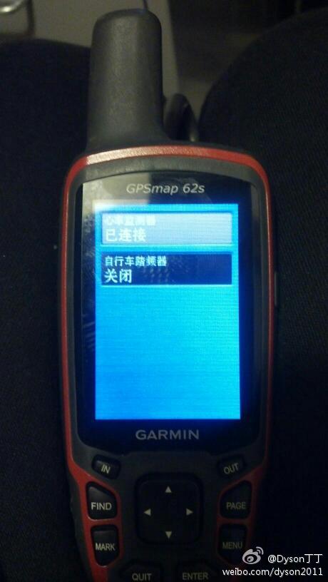
用好友借用的Garmin心率帶與機器成功連接,後天跑一次五六公里看看有無心律數據可以導出來。
可能需要這個軟件
圖為機器與心率帶成功連接:
 Dyson(丁丁)
·
2012-06-09 01:04
Dyson(丁丁)
·
2012-06-09 01:04
新固件出來了,正在升級中")
Changes made from version 3.90 to 4.10:
◦Added new route activity types and improved BaseCamp compatibility. See TrailTech (http://garmin.blogs.com/softwareupdates/2012/05/get-active-with-garmin.html) for more information.
◦Added support for Kenwood NMEA Waypoint Sentence
◦Improved GPS response at low speeds
◦Fixed Spell Search in German
◦Problems with this software may be reported to 62-78Beta@garmin.com
Dyson(丁丁)
·
2012-06-10 05:10
現在覺得4G的存儲卡不夠用了,不知大夥有沒有用過8G或更大的卡?
Dyson(丁丁)
·
2012-09-04 13:25
新固件來啦
Changes from version 4.30 to version 4.40:
Added Adventure support with latest version of BaseCamp. See TrailTech (http://garmin.blogs.com/softwareupdates/2012/08/garmin-adventures.html) for more information.
Added support for new tempe sensor. See TrailTech (http://garmin.blogs.com/softwareupdates/2012/08/tempe-sensor.html) for more information.
Changes from version 3.90 to version 4.30:
Added new route activity types and improved BaseCamp compatibility. See TrailTech (http://garmin.blogs.com/softwareupdates/2012/05/get-active-with-garmin.html) for more information.
Added ability to sort waypoints alphabetically
Added support for Kenwood NMEA Waypoint Sentence
Improved GPS response at low speeds
Fixed issue with preserving routes imported from BaseCamp (identical maps required)
Fixed issue where the map would sometimes not refresh when using the active route page
Fixed issue with the Glide Ratio data field
Fixed Spell Search in German
Fixed possible issue with Where To? > Address searching
Changes from version 3.80 to version 3.90:
Added symbol filtering to FIND > Waypoints and Waypoint Manager
Improved GPS response at low speeds
Fixed daylight saving time issue in Sun and Moon application
Fixed issue that could occur when restoring map zoom level defaults
Fixed issues with support for Canada BlueChart g2 maps
Changes from version 3.60 to version 3.80:
Added Geocaching with Photos (http://garmin.blogs.com/softwareupdates/2012/01/geocaching-with-photos.html)
Improved elevation data stored in track logs
Fixed issue with 'Hut' point type in TOPO Australia & New Zealand maps
Fixed issue with magnetic north offset when projecting a waypoint
Changes from version 3.50 to version 3.60:
Fixed an issue with the reporting of pressure from the barometric altimeter (GPSMAP 62s/62st/78s/78sc)
Changes from version 3.40 to version 3.50:
Added Photo Viewer application
Improvements to the geocaching experience. See TrailTech (http://garmin.blogs.com/softwareupdates/2011/09/improved-geocaching.html) for more information.
Fixed a potential hang on startup when importing large numbers of waypoints, tracks, routes, or geocaches
Fixed issue with very long geocache descriptions
Fixed shutdown when reviewing certain geocache descriptions
Fixed issue where some auto-archived tracks would be named in English regardless of user language
Fixed bug that could cause some geocaches to not import
Fixed issue with track log recording while using the stopwatch
Fixed issue with the anchor drag alarm
Fixed issue with total ascent and total descent fields not displaying values greater than 9999 meters
Modified default map trails to appear as dashed red lines
Fixed potential issue with screenshot color reproduction
Changes from version 3.00 to version 3.40:
Added support for advanced geocache logging with OpenCaching.com. See TrailTech (http://garmin.blogs.com/softwareupdates/2011/08/advanced-geocache-logging-with-opencachingcom.html) for more information.
Added Garmin Spanner mode to GPSMAP 78, GPSMAP 78s, and GPSMAP 78sc devices
Fixed issue with multilingual custom POI files
Fixed issue with setting proximity alerts. The unit of measure can be changed by entering the 'Proximity Alarms' page, pressing the 'Menu' key, and selecting 'Change Units'
Changes from version 2.80 to version 3.00:
Updated magnetic Earth field data
Improved GPS performance
Improved support for BirdsEye™ Satellite Imagery (each provider's imagery can be configured independently)
Increased the maximum number of supported JNX files to 250 from 200
Fixed issues with WAAS/EGNOS
Fixed issue with track navigation sometimes not adding waypoints to the Active Route list
Fixed issue with track and route review from the map page if you came from the elevation plot
Fixed issue with MPC map labels disappearing
Fixed issue with gpi files that have alerts attached to the points
Fixed issue with progress bar displaying properly on power up
Fixed issue with track navigation not adding waypoints to the Active Route list when they are exactly equal to a track point
Fixed shutdown when unit had more than the maximum number of JNX files on it
Fixed shutdown related to topographical maps and land cover text size
Fixed Glide Ratio to Destination field
Fixed problem with profiles and the fields on the map page
Fixed an issue with magnetic north reference and waypoint headings
Fixed shutdown on the map screen when a waypoint was being moved to the same location as a geocache or other POIs
Fixed issue where proximity waypoint alerts could only be set in feet regardless of what was selected as a Distance/Speed unit in the setup page
Fixed an issue with archived tracks not displaying properly
Fixed an issue with having too many custom symbols on the device
Modified the 'Arriving at Destination' message banner so that it no longer appears when navigating to a geocache
Changes from version 2.70 to version 2.80:
Fixed shutdown related to the current track that occurred after updating the software
Fixed a hang that occurred when a unit had 1000 auto-named waypoints
Fixed issue with marine map points sometimes drawing with the incorrect symbol
Changes from version 2.60 to version 2.70:
Added support for chirp™ (62s, 62st, 78s, 78sc).
Fixed problem with certain custom maps.
Fixed problem with certain JPEG images.
Fixed issue with Sight 'N Go and user north reference (62s, 62st, 78s, 78sc).
Changes from version 2.50 to version 2.60:
Fixed issue while using spell search in route planner.
Fixed issue where tracks could not be disabled from the map.
Fixed issues with odometer distance.
Fixed shutdown while panning the map for extended periods of time.
Changes from version 2.40 to version 2.50:
Added Automatic Shaded Relief option.
Added display color to track gpx files
Added import indicator for gpx files
Added multicaching support
Added periodic track archiving
Added track review page improvements
Improved map selection. Visit http://garmin.blogs.com/softwareupdates/trail-tech for more information.
Improved keyboard responsiveness
Fixed issues with inconsistent altimeter readings
Fixed calendar to display all geocache finds and attempts on the correct day
Fixed occasional shutdowns
Fixed paging after logging a geocache
Fixed shutdown on About Page
Fixed spot sounding display on certain maps
Updated map review of tracks and routes. The distance shown is now the distance along the route or track.
Changes from version 2.30 to version 2.40:
Improved display of position formats on keyboard page.
Fixed problem with position entry when using Latvian TM position format.
Removed occasional screen glitch when routes are being calculated.
Added Spanner interface option to 62 models.
Changes from version 2.10 to version 2.30:
Added Geocache Filtering
Added brightness adjustments for BirdsEye imagery
Improved WAAS performance
Fixed intermittent issue with two keyboard input bars appearing on spell search
Dyson(丁丁)
·
2012-09-22 04:09
Changes from version 4.40 to version 4.50:
Improved map drawing at low zoom levels.
Fixed inability to edit archived tracks.
Fixed ability to use NMEA depth for waypoints and tracks.
Fixed display of geocache coordinates with non-default map datum.
Fixed overlapping position text for right to left languages.
Fixed overlapping position text in data fields.
从版本4.50版本4.40中的变更:
改进的地图绘制在缩放级别低。
修正无法编辑归档的轨道。
固定的能力,使用NMEA深入的航点和轨道。
固定显示的藏宝与非默认地图数据的坐标。
固定重叠的位置从右到左的语言文字。
修正重叠的位置数据字段中的文本。
可以插卡吗,丁丁
可以。
官方说明书非常简易,找不到支持多大的TF卡。
2G的可以支持,8G的卡不支持。由于没有4G的卡,不清楚是否支持。
今天把8G的TF卡格式化成FAT32格式,裝進GPS在電腦中還是認不出。")
沒轍,只好改日去買張4G的TF卡拉倒
参考LZ的帖子后,进了62S的机器。
才用没多久,心得不多。
关于插卡,
买机器的时候为了拷点地图,
要了个8G卡,运行没有问题。
曾经问过16G卡,
店主说,开机须地图全部打开才运作,
所以,加装16G的卡会严重影响开机速度。
于是,放弃了。
似乎,可接受的最大是16G卡。
62s水货不是没有全汉化版的么,好像不支持中文输入。行货除外,太TM贵了。
是的,水貨只有中文界面而無中文輸入,慢慢折騰吧
感觉从60csx升级到62s,意义不是特别的大
60没办法显示自制/现成的光栅地图,也不可能加入DEM relief shading的显示效果
丁丁可以测试下俄版1:100K地图的显示效果
仁者見仁,智者見智~
俄軍的地圖始終沒下過,或者把你想要測試的地區發電郵給我?
如能在機器中顯示,我拍下照片傳上來看看效果
那個GLS2005研究過沒?如果好於ASTER和SRTM,那是驢子們的福分啊!
其实450T也不错,硬件配置基本一样.
450T系列除了觸摸屏,還有拍照功能,感覺娛樂性更強些
有機會測試下內置天線和外置天線信號上的強弱對比
幾天用下來,和60CSX相比有以下一些優缺點: [信號] 62S爲14通道,很容易就到3M精度。而60CSX爲12通道,雖然能達到3M精度,但是很少。 [支持地圖] 60CSX能支持CITY和TOPO地圖,海圖未試過。 62S除了以上地圖外…
oregon的操作是在“系统设置”里,把“自动USB模式”改成“手动...”,插入usb供电后选“否”。不知62的系统是否有这个选项
主要是這次62S說明書又是E文,又非常簡易,所以很多內容在慢慢摸索
接口一共五種模式:
Garmin Spanner
自動USB模式
NMEA傳輸模式
文字輸出模式
RTCM模式
沒找到你說的把自動改為手動的功能
幾天用下來,和60CSX相比有以下一些優缺點:
[信號]
62S爲14通道,很容易就到3M精度。而60CSX爲12通道,雖然能達到3M精度,但是很少。
62S,在菜单SYSTEM,设置:WAAS/EGNOS档位,深圳市区也很容易定位到2米精度
60支持海图,不过不能显示G2海图中的港口照片, 也不能自由切换海图和陆图,如果去海上活动,这个限制相当麻烦
60导入的单段轨迹点不能超过500,稍微长点的轨迹都得有几千点,这个限制挺麻烦,不过wikiloc非常好,可以自动切割
62免除了这个烦恼
看来62s除了没有触摸屏,其他都跟400T基本差不多了,如此对户外还是很不错的选择,而且比400T肯定要省电。
应该会支持外接电源,设置中可能有个选项:接外部电源时,是否成为USB存储器。
保持60的省电,键盘操作,增加oregon/dakota系列的新功能,也算是个不错的升级了,就是价格还相对贵了很多
还有一个升级是三轴罗盘,60/400的电磁罗盘倾斜了就乱了,三轴罗盘不会,丁丁没有注意到吗?
地图的处理器速度应该比60csx快吧?
62和450的区别在何处,这两个同期产品着重点各是什么?
为什么在400、450、550都取消天线头的情况下,仍然保持了天线,这样做是否意味着有天线头准确度更高还是什么?
我纯粹不懂就问问,谢谢了。
有天線肯定有它存在的道理,因此我只考慮有天線的GPS,畢竟信號強弱是GPS工作的重中之重
不像手機,現在都是內置的了,很容易就不在服務區
62的价格下不来啊
淘寶買的RMB3199
看出来了,LZ春节闲在家很难受")
新年快乐")
天天加班,呵呵
对了,62s采用的是谁家的gps芯片?
目前我也想知道答案。
這是網上找到的62S線路圖,有高手能看出更多內容嗎?
学习。
最近想出手60CSX,淘宝看了一下,从价格15XX至59XX都有。
请教LZ菜鸟选用那款合适,英文不好要完全汉化的。谢谢!
俄勒岡550T看起來不錯,推薦使用
谢谢!但这个比60CSX还要贵,普遍都在4500以上。是否功能更多,初哥适合用否?
那就買62S吧,有人在打折時花2400元人民幣就買下了
据我的浅薄知识,那种不冒头的用的陶瓷天线,增益比较高,但方向性强,60/62那样鼓出来的螺旋天线增益很低,但方向性弱,各有所长,方向合适的话,陶瓷的灵敏度高
如果以下两个问题解决了我将考虑把目前的60CSX换成62S:
1)中文输入法。
2)小胖熊论坛上有个700多M的中国GARMIN DEM,但是偏移的,需要纠偏。若纠偏后的CHINA GARMIN DEM配合自制等高线,那将非常完美了。
這兩個問題早晚會解決的")
大陆行货也可以不是火星坐标、改用纠偏地图。
纠结在450和62s选择上,登山、徒步用,不考虑开车用,等待丁丁的测试结果
700M的全国DEM相当于70B/平方公里,假定压缩比1:5,也就是原始16bit数据350bytes,大约每公里10点,100米一点,貌似还可以阿,基本就是SRTM的精度,不晓得我算错没
丁丁去下个来看看效果
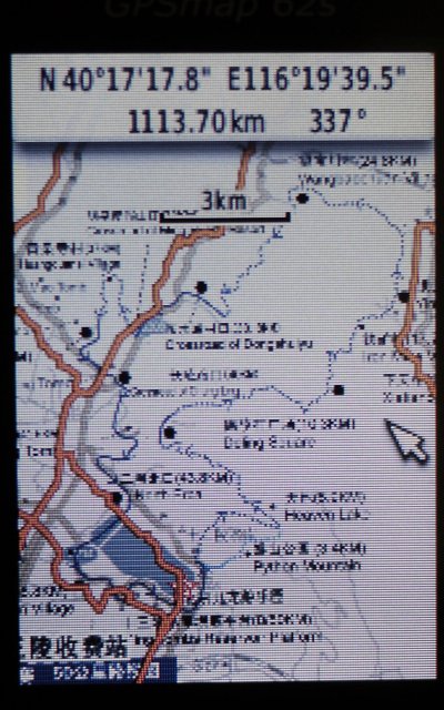
這是全國DEM地圖應用在GPS裡面的情形:
首先要將地圖開啟:
珠穆朗瑪峰兩張
慕士塔格峰一張
全國20米TOPO數據之珠穆朗瑪峰,ASTER格式
20米TOPO數據下載地址(需註冊):
全國DEM下載地址(需註冊):
http://www.sosaw.com/forum43/catalog-51-1.html
警告:全國DEM數據目前是偏移的,無法正常使用!
期待进一步测试。