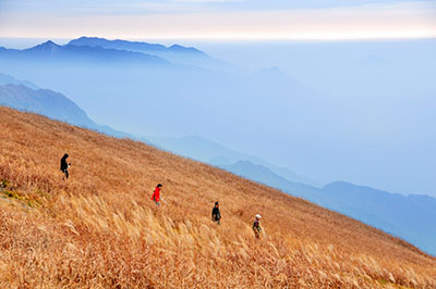
在广州驴界众多前辈的努力下,火龙A线已是路驴佳知,几乎是广州及格驴的毕业考。
By the group effects of senior hikers in Guangzhou, Huolong A Line has been so popular and famous that it looks like a graduation line for hikers in Guangzhou.
这个冬季,有幸在磨坊众多驴界前辈的直接间接指引下,也在火龙A线上荡漾过好几次。可是不是有头无尾,就是有尾无头,甚至是无头无尾,只在中间精华处晃荡一下。当然这也是这条线路的精彩之处,市区里面,可长可短,可高可低,自虐休闲,勤俭腐败,任驴选择。
This winter under the direct and indirect instruction of many senior hikers, I am lucky for having a few chances for hiking this line. But, none of these times of hking is complete, either without the first part, the last part or even the first and last part, just the best part from the middle. Certianly this is the best nature of this line, within the urban area, could be long or short, could be high or low, could be leisure or self abuse, could be thristy or luxury.
未能全走A线,特别是绝望坡这样的路段都还没到过,心里甚是遗憾。虽然强驴们即将本周末带队走A线,到时报名,空降或尾随跟着走一次总不会是问题,但天气预报又说天要下雨,怕到时即使计划不变,走起华南第一坡这样的黄泥路也不舒服。
It’s quite a pity to me for not hiking the whole A Line in one shot. Although senior hikers are organizing hiking this line the coming weekend, and almost certainly that I could either join by registration confirmation, registration without confirmation or even just show up without registration, but whether forcast shows that the coming weekend could be a rainny one, and even their hiking plan keeps unchanged, hiking in the muddy line like No. One Slope in South China could be not so confort.
元月九号有空,早上起来看看雨还没到,于是就出发了。心想自己走通总比随大部队走来得自由,来得自豪。
It’s idle day on January 9. When I woke up in the morning, the whether was still good, so I started off. In my mind, hiking alone is always more free and proud than hiking with groups.
想想从凤凰顶到华南第一坡顶那条A线的撇捺没完整地走过,撇和捺在哪里,如何回合还没把握,于是保险一点,给自己留多点时间和体力,省掉火炉山,从猪仔山起步。
Thinking the two legs between Phoenix Top and No. One Slope Top had not been hiked through in one shot, and not sure it could be completed without guidance, to be more conservative for saving more time and energy, I started from the Zhuzai Mount, omitting Huolu Mount at the beginning.
在涂家祠堂那里流连了一下,快十点半才去到猪仔山脚。一路顺利一路无话,十二点差一刻就去到凤顶了。
I spent some time at Tu’s Clan Accademy and it’s almost half past ten when I arrived the feet of Zhuzai Mount. It went out well with nothing worth mentioned before I arrived Phoenix Top one quarter to noon time.
仔细观察地形,回想前几次的经验,琢磨前辈们的行山指点,心想,不就是从筲箕窝水库堤坝这边的最高点凤凰顶,绕过库尾,到堤坝那边的最高点华南第一坡顶吗?只要我尽量靠左边水库,尽量不离开山脊,自然就能顺着驴道去到华南第一坡顶啦。之后的线路都走过两三次了,当然会没问题的。
I checked the topography. I memorized the past hiking experience and digested the hiking instruction from senior hikers. I thought, isn’t it only from the top of Phoenix Mount at this dam side to the top of No. One Slope on the other dam side by way of the end side of the reserviour? If I kept hiking on the ridge, and to the left side possible, naturally I could follow the hiking way and reach the top of No. One Slope. After that I had been there two or three times, there should be no problem there.
回想3号从华南第一坡下来,右拐走了一个多小时机耕路到华立学院的。当时下到机耕路时作过仔细辨认的。假如下到机耕路对面没驴道,那往右走一点点总能接得上那条驴道吧。
On January 3 when I came down from No. One Slope I turned right and walked more than one hour on the driving way before I reached Huali College. I payed attention to get familiar with the entrance there. If I reached the driving way but failed to hook up with that entrance this time, I should have no problem to do so by walking some distance on the right right.
从凤凰顶下来时,还是信心满挡挡的。
I was so confident when I walked down from the top of Phoenix Top.
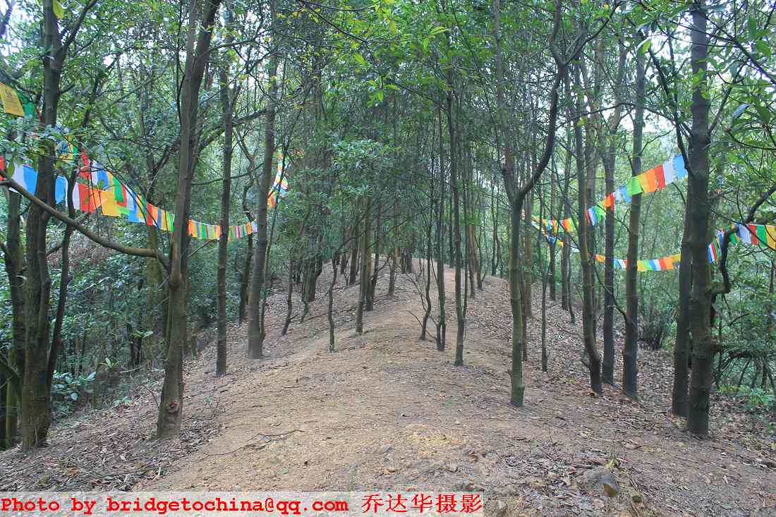
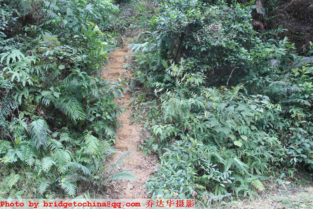
下坡,上坡,过尖,一直在山脊上走。走了一个半小时,第一次发现有点不正常了。线路上有好多个地方挂有佛经彩旗的。一点一刻过后,到了一个驴道随防火道右拐的地方。前行的山脊却挂了一大片彩旗。不要说前行,要到彩旗那里去都有困难的。几经观察,当然只能随驴道右拐。
Down this slope, up that slope, pass the peak, I always hiked on the ridge. Half an hour later, I for the first time found something not so right. On Line A, there are a few places where Budha Flags were hanged. After a quarter past 1PM, I arrived a hiking right turn place but many Budha Flags were hanged on the ridge front side. Not to mention hiking through, it’s even difficult walk close to the flags. After careful checking, one could only turn right as the hiking way goes.
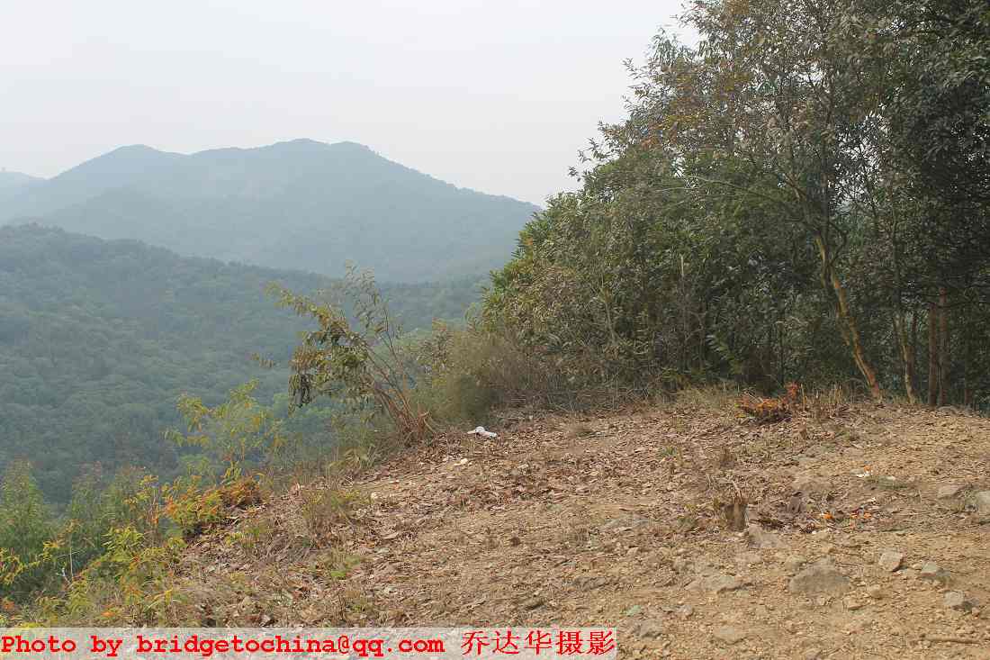
才五分钟这样子,防火道上的驴道又拐右,但防火道直上一个很陡的尖。我先右拐几十米,发现那边的驴道平缓地上尖顶。于是回头上尖顶瞭望。原来另一侧的防火道也很陡也有很成熟的驴道。那尖顶是个瞭望的最佳位置,和左前方的凤凰顶和右前方的第一坡顶构成了等腰三角形的样子。眼前视野没任何阻挡,周边山貌清清楚楚。仔细观察那里曾经装过三角铁架。
About 5 minutes later, the hiking way on the Fire Protection Way turns right again, but the Fire Protection Way keeps straight forward and up to a very steep peak. I followed the hiking way to turn right for tens of meters, then to find out the way to the peak from that side is much more smooth. So I returned to the peak for an out look of the surroundings. It turned out there is very steep hiking way on the Fire Protection Way on the other side too. That peak is the best outlook place out there, and it forms an isoscele triangle like that. Nothing hindering in the view scope there, with clear view of all the enviroment there. Careful check, one could find that one triangle metal tower had been set up there.
不知道大家说的A线上的绝望坡在哪里。在我看来,这里叫作绝望坡最恰当。不是因为它两边的防火道都很陡,而是因为它面向水库那边就是很深的峭壁,一颗树都不长,只长了很多小草掩盖了其惊险性。绝望了到那尖上去是很容易解决的。带小孩去那观景是要拖手才好的。有条件时,安装护栏是有必要的。
No matter where the Hope Ending Slope was popularlly recognized, in my mind, this is the best place to be called Hope Ending Slope. Not because two of the three Fire Protection Way are very steep, but because the side towards the reservior is a very deep cliff without a single tree, only bushes growing there to hike the danger. Any hopeless one could get rid off trouble eaily by getting out there. When kids were brought there for signseeing, hand holding by guiding adult is a must. Protection bar has to set up when facility available.
遵循靠左山脊的原则,我从对面很陡的山脊驴道下行。过一新水泥机耕路,对面继续防火带驴道。约半个小时到另一山尖。那里有11号界碑。想想和第一坡顶的10号界碑只有一碑之距了,心里好象看到了希望。
According to the left side ridge principle, I walked down the peak by the ridge on the otherside. I continued the hike on the otherside after crossing a new cenment road in one pass. About half an hour later, I arrived another peak where No. 11 Mark Stone is. It is only one mark stone away from the 10 Mark Stone on No. One Slope, I seems seeing success aproaching.
这里也有前行和右拐两条放火带上的驴道。到这里看看,水库好象就在眼皮地下。这时很想走对,很想下山脊过机耕路对面就是3号从北坡下来那个驴道口。
Here there are two hiking lanes on the Fire Protection Way for going forward and turning to the right.. Looking from there, the Resorvior seems just right below. Right then I just hope to be right connected to that entrance after getting down from the ridge
于是放胆走右边那条驴道。走呀走,走呀走。下山脊过一新修的水泥机耕路。跨过去再爬上山脊上的驴道。心里还想他妈的破坏得还真厉害,修这么多水泥路上山。为了赶路没多想。走呀走,走呀走,前面的山尖也很陡。鼓足气力冲上去,赶快瞭望一下看北坡入口到了没有。
So I bravely turned to the right. I walked alone, walked alone. After getting off from the ridge and crossed a new cenment road, I climbed up the ridge on the otherside and hiked on. I thought to myself, dame them, for buiding so many cenment road to destroy the mountain beauty. I did not think too much for rushing forward. I walked alone, walked alone. The peak front is also very steep. I did my best to rush up to the top, quickly turned to the Reservior side for an outlook and see if the entrance for the No. One Slope out there.
妈呀,这不是绝望坡吗?这时还看到有条蛇,见我来匆匆往悬崖边的草丛钻进去了。这个季节还有蛇还真奇怪。这时已经是两点20分了。上次到那里时是一点22分。
My lord. Isn’t it the Hope Ending Slope? I saw a snake then, rushing into the bush before I arrived. It is too strange to see a snake at this season. It was twenty past 2PM then, last time here it was twenty past 1PM.
这时我看到了失败的可能性。A线我可能又走不通了。急匆匆我又往11号界碑奔。再到11号界碑时才两点39分。沿途我两边都看,看我到底右拐后怎么回到原路重返绝望坡顶的。还看不到有岔路,难道我到11号界碑后转个180度往回走?真的不可思议。
Then I saw the possible failure. I would fail again to hike through A Line. In a rush I hiked back to No. 11 Mark Stone peak. It was 21 to 3PM when I arrived there. I watched out for branch on both sides. I did not see any. It is encredible. Did I make a U turn to rush back when I arrive No. 11 Mark Stone peak last time?
重到11号界碑后不敢转右了,左边的防火带驴道直接下去。下到一条机耕路,和三号北坡下来走到水库尾那条有点象。连下来的山脊都象,但对面的山脊就完全不一样了。对面是废弃的放火带,杂草丛生。有的驴道好象本冬季就没人走过。
I dared not to turn right again when I returned to the No. 11 Mark Stone. I went down from the Fire Protection Way on the left. When I arrived the Driving Way, I found the way is a little bit like the way I walked on January 3. Even the ridge coming down is also familiar. The ridge on the otherside is totally different.. It looks like an abandent Fire Protection Way, with all the glass growing. If there was a hiking lane, it wans’t used by any one this season.
于是右转,寻找心目中3号走过的北坡出口。左边路边有两条小驴道上山,但是丛林线路来的,不敢跟。但机耕路又越走越不像3号走的。
So I turned to the right, in seek of the entrance in my mind. I saw two entrnace on the left side for going up, but it is little one in the bush and I dared not to follow. And the Driving Way turns out to be more and more different than that one we walked on Jan. 3.
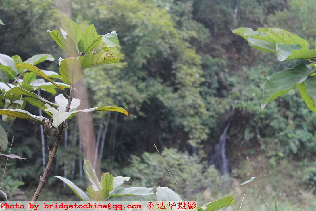
走了二十来分钟,来到一个右边有连串小水库的地方,象梯田一样从上而下在路的右边排列。其中一个高度差大的地方,居然有个小瀑布,甚是稀罕。
For about 20 minutes, I arrived a place with serries of reserviors lined up on the right side. At one place with big height distance, there was a waterfall. Quite a rare sight.
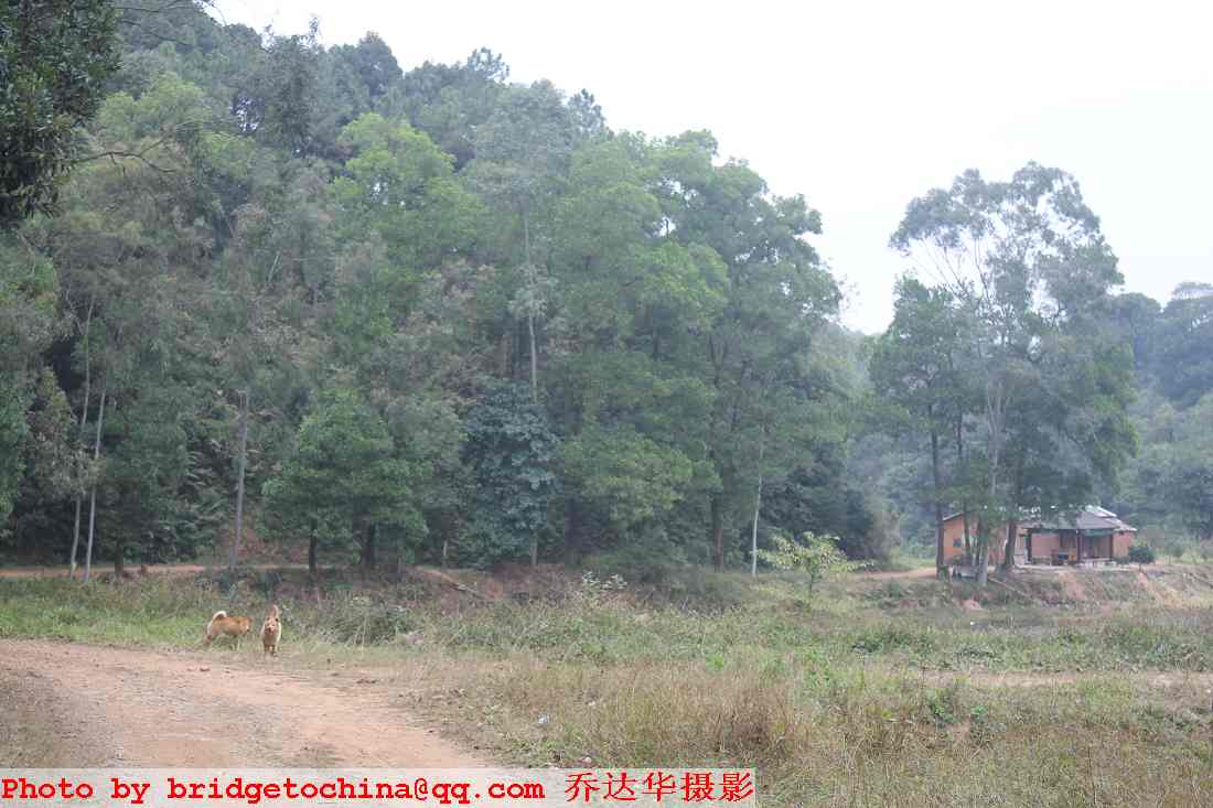
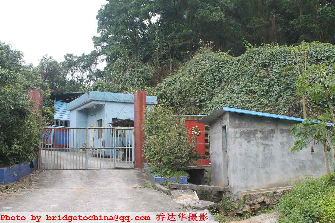
远远看到某个小水库旁有小屋。还隔着整个水库,我还没到那个水库旁,远远那边的小屋就冲出几条恶狗,飞奔直冲到我跟前。真的见鬼了,吓得我几乎濑尿。好在它们见我站着不动,就只是在我面前对持。小屋那边好象还没有人,要真跟几条恶狗打起来,我虽然有登山杖作武器,还真的不一定能胜过它们。要真能打败几条恶狗的话,狗主人出来时肯定会带斧头的。
In a far place I saw a little house. Still on the other side of the reservior, I was still not by that reservior yet, a few bad dogs rushed out and ran to my side and blocked my way. It is reticulars, I was almost frighten to be pissing off. Still good that then they saw me stand still, they also just stood in front and confront with me. Seems no one was there in the little house. If I had to fight with those bad dogs, even with the hiking stick as tools, possibly I could not win over them. Even if I could defect those few bad dogs, their host could show up with axes.
好人不和癞狗斗,老夫只能倒回头。
I got to turn arround as wise men do not rush in to fight with dogs.
回到下山的地方已经是三点四十分左右。失败已成定局,收工又嫌早了点。在下山点看仔细些,发现机耕路是通往华立学院背后方向的,水库和华立学院还在底下。莫非他还之字型拐到前面山的那边?心目中的北坡出口就在前面山的那边?还有一条野道通往山那边,虽然没标志,虽然杂草丛生,但走过去不远的山那边果真是心目中那个北坡出口的话,还来到及走完A线。
It was about twenty to 4PM when I arrived back to the exit place. It became obvious to be a failure hiking, but still a little bit early to call it a day. Before I left I carefully checked again and found that the driving way is leading to the back side of Huali College, the reservior and the college are still far below. Could the driving way turn back on the otherside of the hill not far in front? The entrance in my mind could be not far on the otherside? There is a bush lane towards the other side of that hill, without any marking, almost covered up by bush, but if it could reach the entrance in my mind not far in the other side, I could still have enough time to finish A Line on time.
这个时候再探路还真的有点不对。但当时是急了,想着最多往回走。就顺着那条野道冲过去了。到山那边顺着防火道下了很陡的斜坡后,心都凉了。下面是条很窄的峡谷,一点驴道的痕迹都没有。赶快看看手机,有信号,有余电,最坏的情况是请蓝天救援的大哥们喝两杯。于是坚决不爬陡坡走回头路,而是在山坑下面找出路。
At that moment of the day, it is a real mistake to probe for hiking ways. But in a rush I made that decision, thinking the worst case could be retreated from the same route. I rushed to the otherside of the hill by that wild lane, then declined down to the valley by the quite steep Fire Protection Way. My mind was frozen when I arrived the very narrow deep valley where I could see no chace of hiking. I checked my mobile. Signals available, and battery still powered up. The worst case could be that I invited Rescuse Brothers from Blue Sky Rescue Team for a cup of drink. So I insisted on not returning but search for way out down in the valley below.
好在,看到整片的大蕉树。人家收大蕉的总会留点路给人走一下。那山脚的草地是越走越宽,越走越象路,越走越有人气,我的心才定下来。最后看到小路旁五棵整齐的大桉树,我的心就放下来了。我以为是走到筲箕窝旁边某个村子了。
It is good sights that I saw a bundle of banana trees. Banana harvestors must leave a trace for others to follow. The glass land at the valley turns out to more and more like ways, more and more broad and more and more populated. My mind calmed down then. When I saw 5 big eucalyptus lined up there, I became relaxed. I thought I arrived a village somewhere arround Shaojiwo Reservior.
继续走,村子的影子都没有。环顾四周,植被茂盛,一片荒芜,好生奇怪。继续再走,突然来到了崭新的水泥路,走近才发现,是水泥路的尽头,象个巨头的逗号,能停好几辆车。
I kept hike on. I saw not a single trace of village. Looking arround, heavy forest, all covered by plant, so strange. Hike on again, suddenly I arrived a brand new cenment road. It turns out when I got close to be a giant comma, with capacity of parking a few cars.
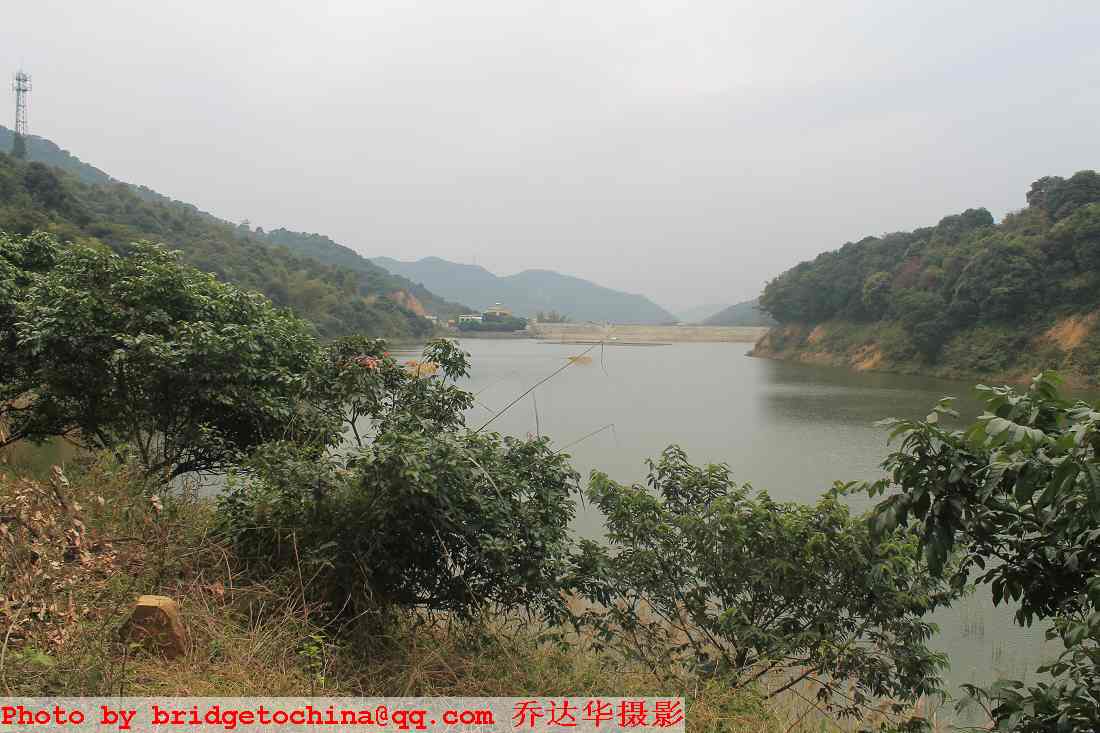
沿水泥路走,过小型水库,过一批巨大的棕榈,居然来到一铁门处。没人,门开的。门口外一看,上书大源水站。我的天,这一翻,我翻过了华南第一坡,去到了大源那一边。
By the cenment road, I passed a small reservior, I passed a few big palm trees, then arrived an iron gate. The door is open, no one there. I checked when I came out. Dayuan Water Station was written in front of the gate. My lord., for this cross over, I already crossed the No. One Slope in South China and reached Dayuan on the other side.
我是记得好友畹九指点说第一坡上那条水泥步道通到大源水站铁门处的。当时才四点刚过,寻得那条步道上第一坡还能按原计划走完A线。但当时惊魂未定,又贪大源水库那边没到过,新线路总多点未知在那里诱惑,我就简单地沿水泥路往大源方向走去了。一直走到沙太路大源站坐车回。
I remember Buddy Wanjiu telling me that the cenment step way from No. One Slope in South China reached to the iron gate of Dayuan Water Station. It was just over 4 PM then, I could still complete the hiking of Line A according to original plan if I could find the cenment step way and hike up. But I still at a lost by then and also I like the temptation of new routes, so I simply walked towards Dayuan Reservior by the cenment road., until Dayuan station at Shatai Road for bus towards city center.
好长好累人的水泥路,坐上808回东站还大塞车。好在居然塞在了京溪路口,我的位置正对路中央,让我欣赏了千年古道的新貌。
It is a tiring long cenment road. There was a traffic jam when I boarded bus 808 for East Train Station. It is good that the bus I was on was blocked just in front of Capital Valley Old Road. My seat was just in line with the central of the old road and I got the chance to appreciate the new look of the thousand years old road.
如果我没想错,骑马时代的广州市长要上北京或南京述职都要经过那里的。冥冥中,他们会否被握手楼的怪象笑醒?
If I made no mistake, Mayors in Gaungzhou at horse riding times had to pass the road there when they traveled to Beijing or Nanjing to report to the Emperor. In the heaven, will they be waken up for the strange of handshake buildings?
十点一刻还在这里流连。满以为这是个休闲的一天。

十一点四十三到凤凰顶这。这是老人的速度。

三道山脊,前两道断估也不会有驴道岔出去。

差十分到一点,看两边的佛经彩旗我还多谢佛祖保佑。
一点十七分看到的这片彩旗,我花了好几分钟都搞不清楚是怎么挂上去的。那边更没有驴道。与时俱进,菩萨有时也开点玩笑,娱乐大众。

一点22分初到绝望坡,驴道右拐,直行比较陡的,站着拍的照片不明显。
一点54分到11号界碑,以为快成功了

11号界碑这看筲箕窝水库觉得很近,就选择右边的驴道了

两点16分再到绝望坡。我是知道绝望坡风景好,但不至于好到要当天回头欣赏。我是到瞭望那一刻才意识到走了回头路的
两点39分,再到11号界碑

这次到11号界碑后不敢转右,直行下到这里,机耕路对面山脊无路,于是转右寻路。

很快有条这样的上山小路,不是心目中那条不敢跟
走了好大一会见一窜这样的小水库,还有飞瀑

看着它们从小屋那边出来飞奔过来的。前面即使有奥运冠军金牌,我也没办法过去拿。
回到下山点,一时冲动从这野道走过去,以为山那边还是折回头的机耕路,并且对面就有我们北坡下来那个山脊入口

很陡的山脊下到这样的谷底,这时想到有需要麻烦蓝天救援的可能性

好在寻到山路,看见蕉林
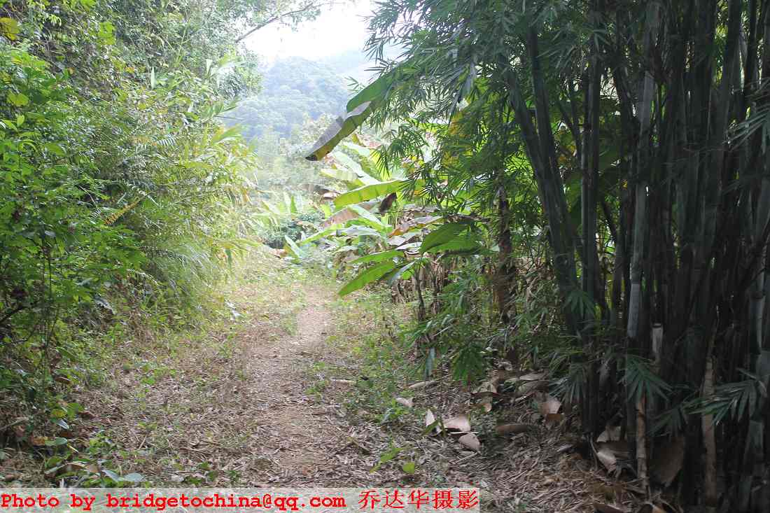
看见几棵靓仔桉,有点象到家的感觉。敢确定不用麻烦别人的了

来的这个大逗号这里

大源洞?三王爷水库?

最纯净的水,可以加工成最纯净的冰,到这里感觉很安全了,但很纳闷自己到底到了什么地方

赶快出来看看,原来是大源水站,非常意外
大源水库
真的是天意,还能这样让我欣赏京溪古道‘美景’
想起上京古道,徽杭古道,吴越古道,徽白古道,龙王古道。。。。。。还有,整个城市都是文物古道的Brighton.

照片发完了。谢谢所以阅贴的驴友网友
好高级,中英双语的
谢谢。就是双语而已,并不因此而高级。驴子最脚踏实地。
非常敬佩华哥独闯“龙潭”之大无畏气概,希望能尽快实现扫A宏愿!
谢谢。市区的线路,有什么可怕的。市委市政府应该先化一届马拉松的钱,将白云萝岗那片山整理一下,让全体市民都可以放心出驴,这样才办马拉松,就不会死人了。
生态很脆弱的,大山也不一定坚强。据说市委某位书记是学生态学的。这样残忍的行为怎可容忍?
快到凤顶时,我边走边想点东西,有点入神。
突然后面传来山猪的呼吸声,吓得我脊梁都被电击了一下。
原来是他来了。才搭了半句话,他又离我而去了。
不知道在修的是什么东西,总之不太自然。看来是有个很大的毁坏工程正在进行之中
高压线塔桩基础,人工挖孔桩,对环境很大的毁坏说不上。
楼主住京溪?老夫就住附近,也喜欢在山上随意走动,有机会可以一起
水哥好。‘绝望坡尖’和11号界碑尖很象的,中间隔新建、在建水泥路垭口。我第一坡目标明确,居然走了回头,到现在还想不明。
上会拉练被黄埔驴友带回头时我就已经过了这里。这里的瞭望也很美。这棵树很有特色。希望它能茁壮成长。大家驴友方便时给它上点液体肥料。
这样拉根绳子,那样绑条红头巾,这样的经费登山协会出得起的吧?
这是0号界碑对面的公渔岭入口。
原始一些好~
是原始的好。所以登协或体育局只要花一点点钱,订些木指路牌,危险处拉点绳子之类就行的了。
绝望坡看第一坡,看凤顶一样这样清楚的,镜头不好没拍下。
广角镜可以全部拍下,相当的漂亮
这次到11号界碑后不敢转右,直行下到这里,机耕路对面山脊无路,于是转右寻路。
山脊是有路的,由此光秃小土坡直上山脊即可直达北坡10号界碑处,楼主走过的前段加上由此路直达北坡再去龙洞应该就是驴友所称的火龙A了。
谢谢,谢谢。
上月底第一次走火凤线,见你们在火炉山培训后备人员,我们一家几口有幸旁听了一会的。
还以为你们是登山协会的,登山协会和全社会对你们的工作应该是大力支持的。
61136119是广州蓝天的电话,我没弄错吧?
走了好大一会见一窜这样的小水库,还有飞瀑
谢谢岑爷光临,江湖里说你光着脚能走完火龙线,无限敬仰!!
那狗是好心呀,如果不挡住你一直顺着大路往前走的话,走到最后就是梯子岭的山谷,那是没有村子没有车的断头路哦,不懂得翻过山岭出来的话还得原路返回的呢~~~见过那狗几次,真的挺友善的呢~~~
看着它们从小屋那边出来飞奔过来的。前面即使有奥运冠军金牌,我也没办法过去拿。
多谢畹九指点。
公渔岭很靠近广河高速的了,我走对了。绝望坡也上了。
绝望坡之后最近的上第一坡的路口在哪里?
安卓、爱疯、赛班都有记轨迹的软件。
安卓的可以Oruxmaps
看看这样的植被,感觉南国就是好
大源洞?三王爷水库?
这就是三王爷水库啦。
居然这样绕过那只大足球
还有 韶关梅关古道 深圳梧桐古道 乔兄再接再厉 有多远走多远.......
是很想走走广东家乡的古道的。去年11月23号走赣韶高速路过梅关古道,专门停车凭空追思了一下。古道之好,在于可以帮你将思绪的时空释放好多倍。
走到11号界碑是正确的
到11号界碑之后右转我莫名其妙地走了回头路,再次到11号界碑后直走下比较陡的防火道到机耕路。之后我就错了。
中国登山协会是中华人民共和国组织、管理和推进登山运动的唯一的全国性机构,广州市极限和登山运动协会(简称广州登协)是经政府社团登记管理机关核准登记、接受市体育局业务指导的具有法人资格的非营利性专业体育社会团体;广州蓝天救援队则是由一批热心社会公益事业的户外运动爱好者志愿自发组成的一个从事户外遇险救援的民间公益性团体。登山协会与蓝天两者是不同的,可以理解为一个是官办,一个是民办。蓝天救援队全国的公益救援热线是400-600-9958,广州蓝天除了接受全国蓝天公益救援电话的调度外,还有自己的公益救援直拨电话020-61136119,公益救援电话24小时有人接听,接受以山野援助为主的求援求助,尽已所能、守望相助!
火龙A轨迹图(绿色线)
你所说的“绝望坡”应该就是公渔岭的岭尖,看红色三角确实与凤顶和华南第一坡形成一个等腰三角形,但这一点点的陡度虽然比较陡,但才三十米长,一分钟不用都可以上到顶,哪里称得上“绝望”?!
真正驴友界所称在绝望坡在凤顶与你所看到的水泥塔基之间的那段,你从上向往走,一阵风就下去了,当然没有什么感觉,真正绝望的感觉是走火龙火和火帽火往回向上走的时候,那段不断向上怎么也走不到顶的感觉在累极的时候真的有点令人“绝望”!
下到第一机耕路你往前上公渔岭是对的
下了11号碑到了这里的第二机耕路你往右去就错了,那是古井的方向,绕了一个圈后你走到了大源水库(黑色线);你如果往前上小土坡就对了,山脊上有路,可以直达华南第一坡(绿色线);往左走是绕第二机耕路回到龙洞筲箕窝水库(红线)。
谢谢你指点。看到救援队的人都觉得亲切的。
去年11月初时随绍兴新昌县的一支驴队穿越雁荡山,一不小心迷路了,全队三十多人在到处峭壁的大石山里出不来。晚上9点才报警,当地应急办求援队,公安局求援队,登山协会救援队三支队伍出动了。凌晨一点多才找到我们,给我们送来照明,食品饮料和御寒服装。最终我们要熬到天亮才敢出山。