本来是要放在这个贴子里的:美国加拿大海洋舟名地之二 -- 波士顿海港列岛 (1)2013活动
但是2012活动的让人难忘,照片之多,活动之成功,就单独开贴把。

 kurtyang04
·
2014-08-01 18:17
kurtyang04
·
2014-08-01 18:17
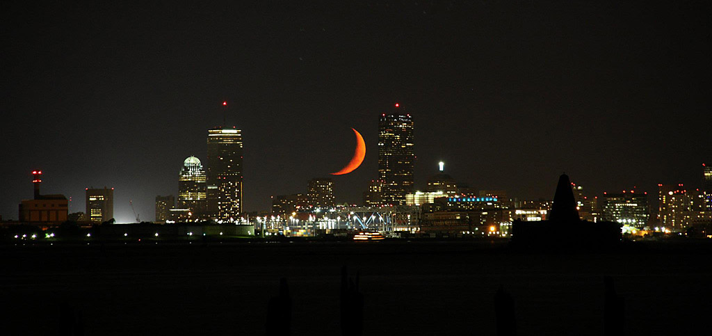
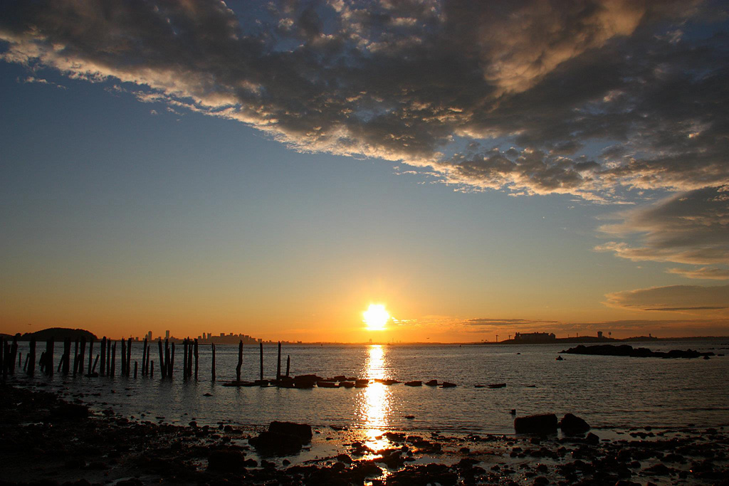
上面的月亮是我人生见过最美的一个,无任何PS。
波士顿海港岛, 是美国最有名的都市列岛,分外岛和内岛。 外岛人烟罕至,内岛变成了国家历史公园,有露营地, 军事城堡,历史遗迹,供大家参观,露宿,停留休息, 没有任何商业运作。而内岛露营也许是北美城市最为风光独到的一个。
从海洋看波士顿城市轮廓线,夕阳下无比辉煌
from wiki:
Boston Harbor is a large harbor which constitutes the western extremity of Massachusetts Bay. The harbor is sheltered from Massachusetts Bay and the open Atlantic Ocean by a combination of the Winthrop Peninsula and Deer Island to the north, the hooked Nantasket Peninsula and Point Allerton to the south, and the harbor islands in the middle. The harbor is often described as being split into an inner harbor and an outer harbor.[6][7][8] The harbor itself comprises fifty square miles with 180 miles (290 km) of shoreline and 34 harbor islands.
Inner harbor
The inner harbor was historically the main port of Boston and is still the site of most of its port facilities as well as the Boston waterfront, which has been redeveloped for residential and recreational uses. inner harbor extends from the mouths of the Charles River and the Mystic River, both of which empty into the harbor, to Logan International Airport and Castle Island, where the inner harbor meets the outer harbor.
Outer harbor
The outer harbor stretches to the south and east of the inner harbor. To its landward side, and moving in a counterclockwise direction, the harbor is made up of the three small bays of Dorchester Bay, Quincy Bay and Hingham Bay. To seaward, the two deep water anchorages of President Roads and Nantasket Roads are separated by Long Island. The outer harbor is fed by several rivers, including the Neponset River, the Weymouth Fore River, the Weymouth Back River and the Weir River.[6][7][8]
Dredged deepwater channels stretch from President Roads to the inner harbor, and from Nantasket Roads to the Weymouth Fore River and Hingham Bay via Hull Gut and West Gut. Some commercial port facilities are located in the Fore River area, an area which has a history of shipbuilding including the notable Fore River Shipyard.[6][7][8]
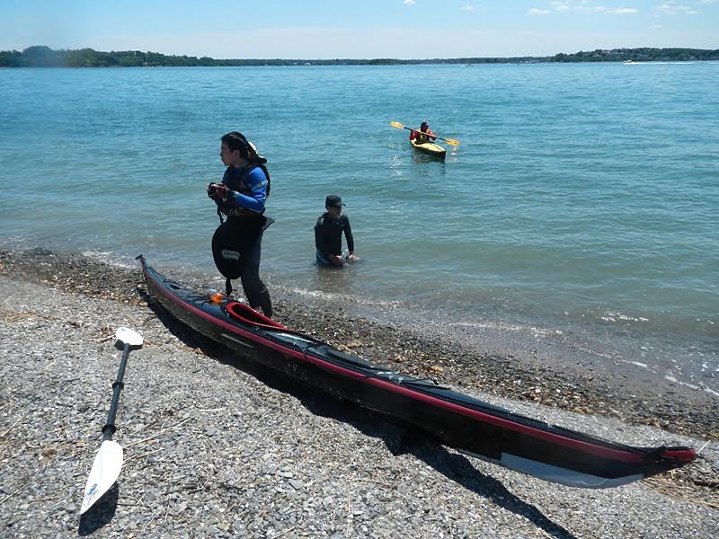
kurtyang04
·
2014-08-01 18:20
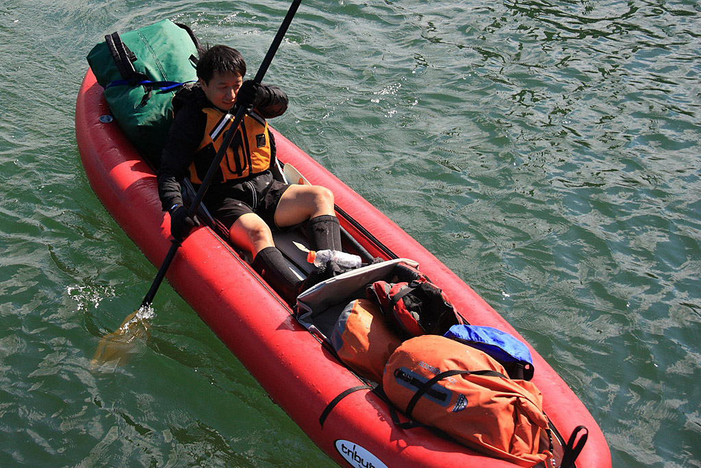
由于距离短,船舶交通繁忙,不可预测浪可达1.5米,公开水域,新人比重大,运输的困难,我们这次活动采用AIRE TOMCAT 非硬船。船嘛,对我们主要是工具,只要把我们安全带到目的地,慢一点问题不大。
当 天晚我们是在某个小岛上过夜的,于是从HULL趴车场装满腐败的货物,划向3公里外的露营岛。跨过海上通道时,遇到几个一米的浪和强劲洋流, 我们离第一个跳岛乔治岛偏移了半公里以上, 过了主航道后,调整靠岸。从乔治岛到露营岛LOVELL相对风平浪静。
kurtyang04
·
2014-08-01 18:28
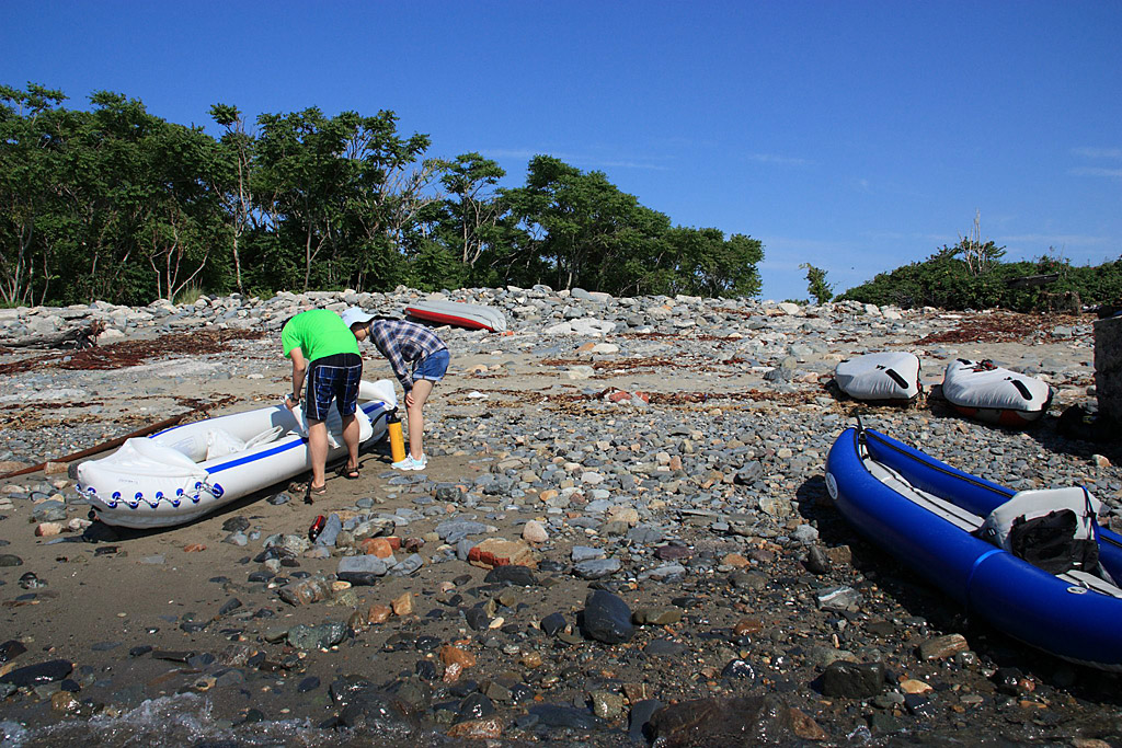
皮划艇下水之处:

 kurtyang04
·
2014-08-01 18:40
kurtyang04
·
2014-08-01 18:40
杀向目的地:
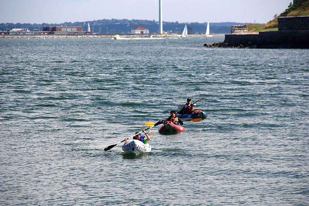
满载生活用品的TOMCAT
 kurtyang04
·
2014-08-01 18:43
kurtyang04
·
2014-08-01 18:43
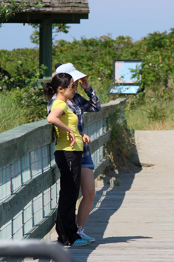
两位美眉是搭乘轮渡上岛,加大了安全系数
在眺望远方的亲人和朋友

 kurtyang04
·
2014-08-01 21:31
kurtyang04
·
2014-08-01 21:31
上岸卸货
搭建帐篷

 kurtyang04
·
2014-08-01 21:36
kurtyang04
·
2014-08-01 21:36
没过多久天空乌云密布 , 是暴风雨来临的预兆,于是海湾的那边是风暴中的波士顿
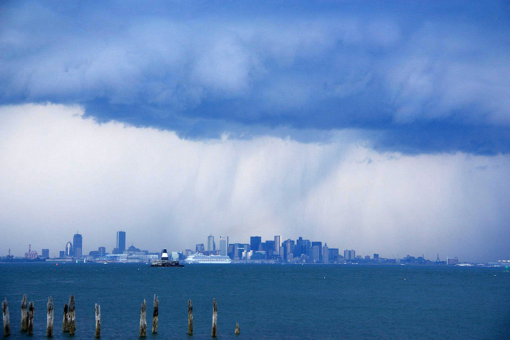
风暴是种美
 kurtyang04
·
2014-08-11 14:47
kurtyang04
·
2014-08-11 14:47
让暴风雨来得更猛烈把!
这暴风雨来得真快,还没一会功夫,波士顿城区那边的云层降临到小岛附近,雷鸣电闪。

还好,帐篷已搭,大家纷纷躲进帐篷避雨。风是十分地大,感觉要把帐篷连人一块吹走,雷是特别地近,天上无数炸开的锅。记得当时我祈祷,这闪电别在我们营地释放。同帐篷88后用scream尖叫来宣泄一种恐惧,激动,兴奋,于是我跟着狂吼,仿佛时光倒转十几年,感受88后飞扬的青春和天真。
 kurtyang04
·
2014-08-11 15:13
kurtyang04
·
2014-08-11 15:13
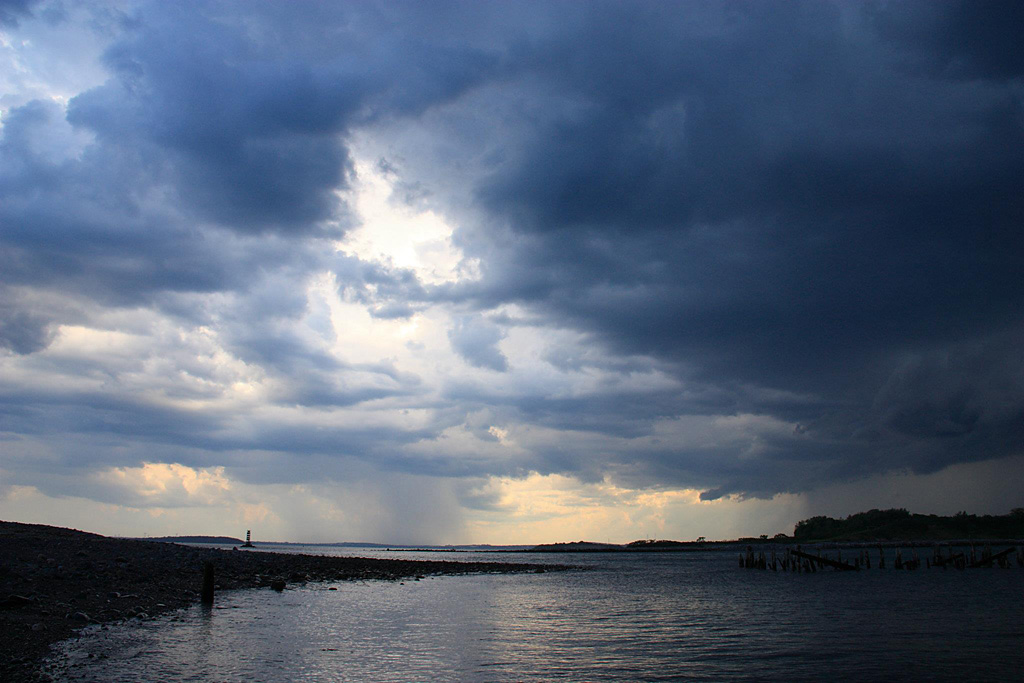
这风暴来得猛烈,走得也快。不一会雨停,小伙伴们走出帐篷,交流着心情和经历,谁的进水了,谁的东西被吹走了,一点沮丧都没,反而是刺激和兴奋。如今回想,这么多年多天的露营,风那么强劲,雷那么近,是头次,而且是在一个小岛,坐望波士顿的小岛,经典从不重复, 天气是户外特别是水上运动,活动戏剧化的重要因素。

 kurtyang04
·
2014-08-11 15:25
kurtyang04
·
2014-08-11 15:25
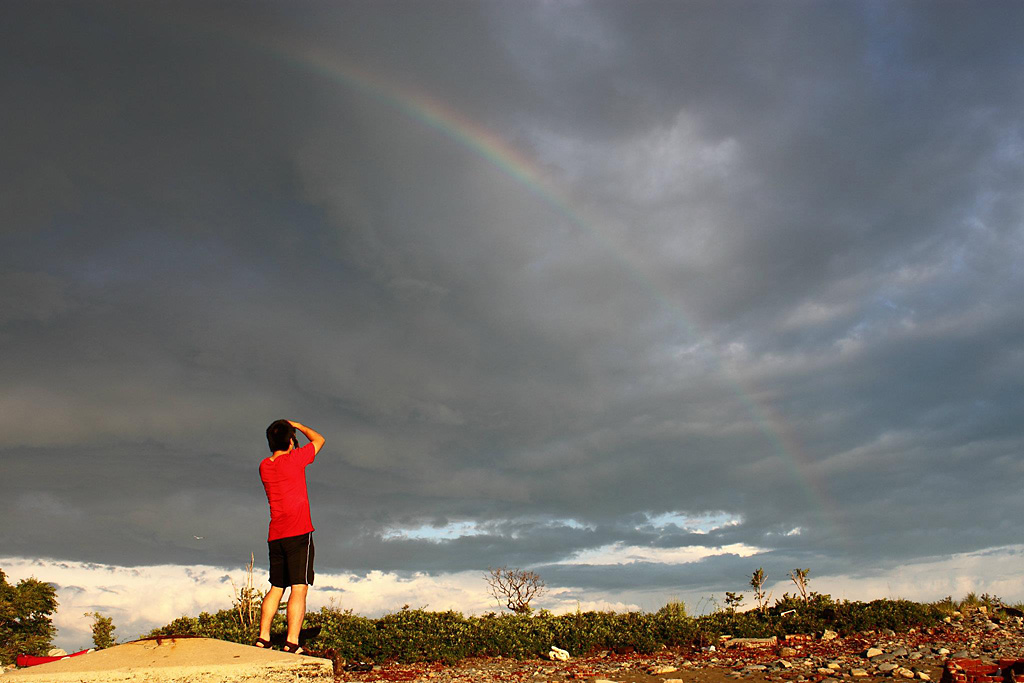
暴风雨后必有彩虹
 kurtyang04
·
2014-08-12 12:34
kurtyang04
·
2014-08-12 12:34
没风时,软艇还好。
澡无法洗,淡水自己带,秋天少出汗比较适合。
kurtyang04
·
2014-08-12 18:30
有张图可能不雅观,就只给连接把。
http://static.doyouhike.net/files/2014/08/11/8/87fb3c97766150859a65f1e8ae527162.jpg
 kurtyang04
·
2014-08-12 18:45
kurtyang04
·
2014-08-12 18:45
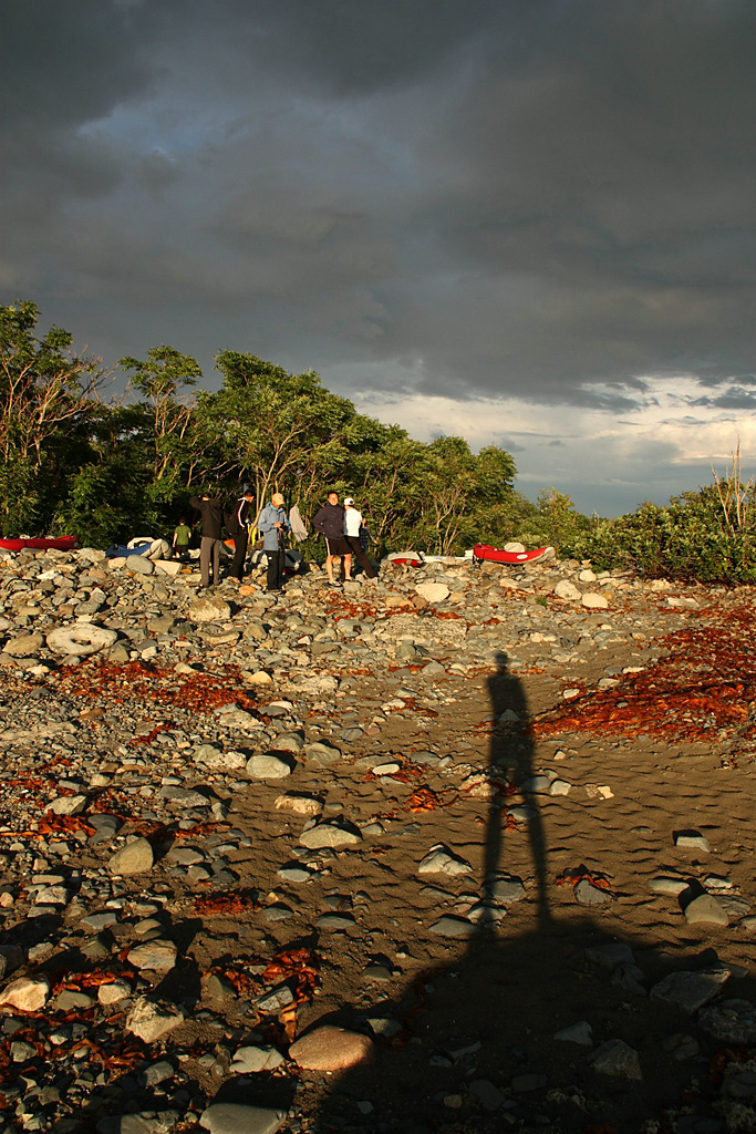
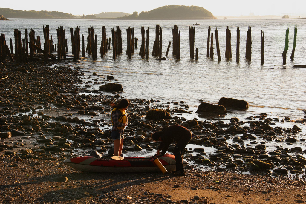
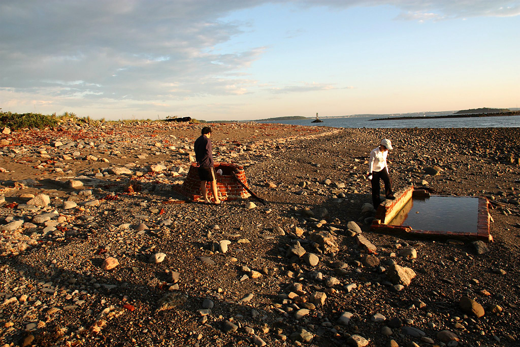
这里的小岛往往有一两百年前留下的遗迹
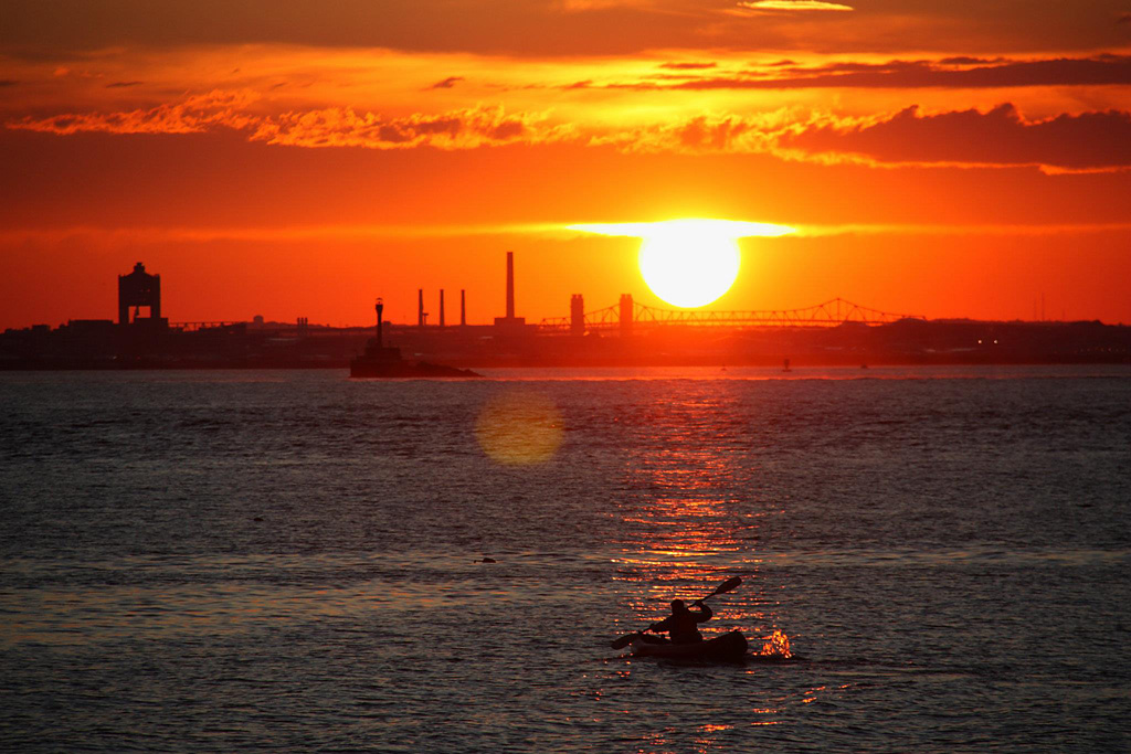
摄影师88后

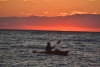
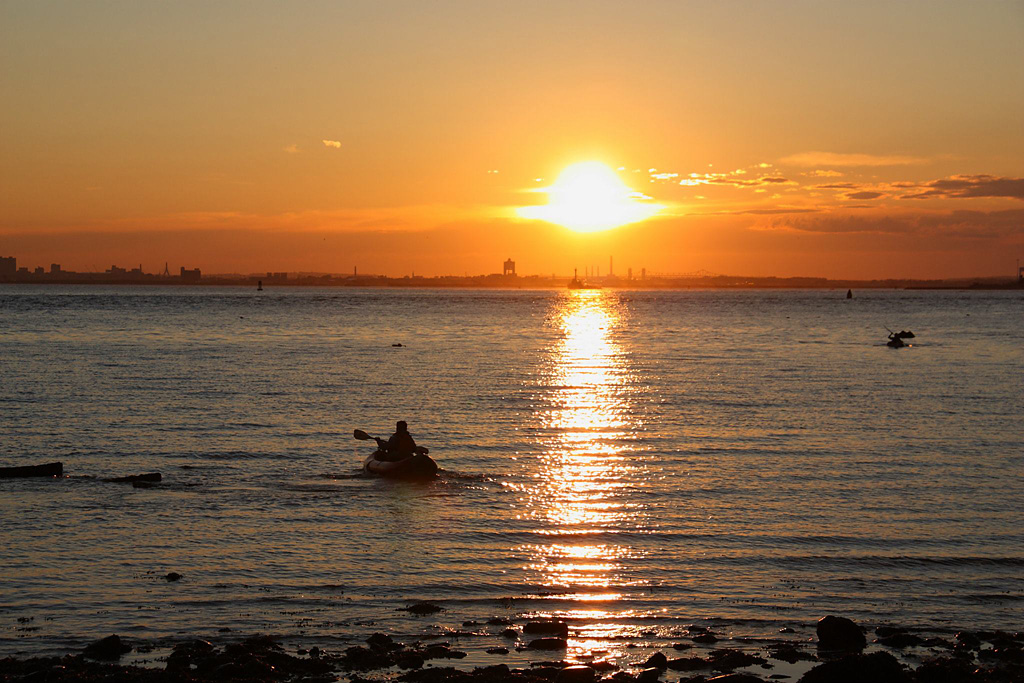
落日前的皮划艇是一天最美的时光
 kurtyang04
·
2014-08-27 18:40
kurtyang04
·
2014-08-27 18:40
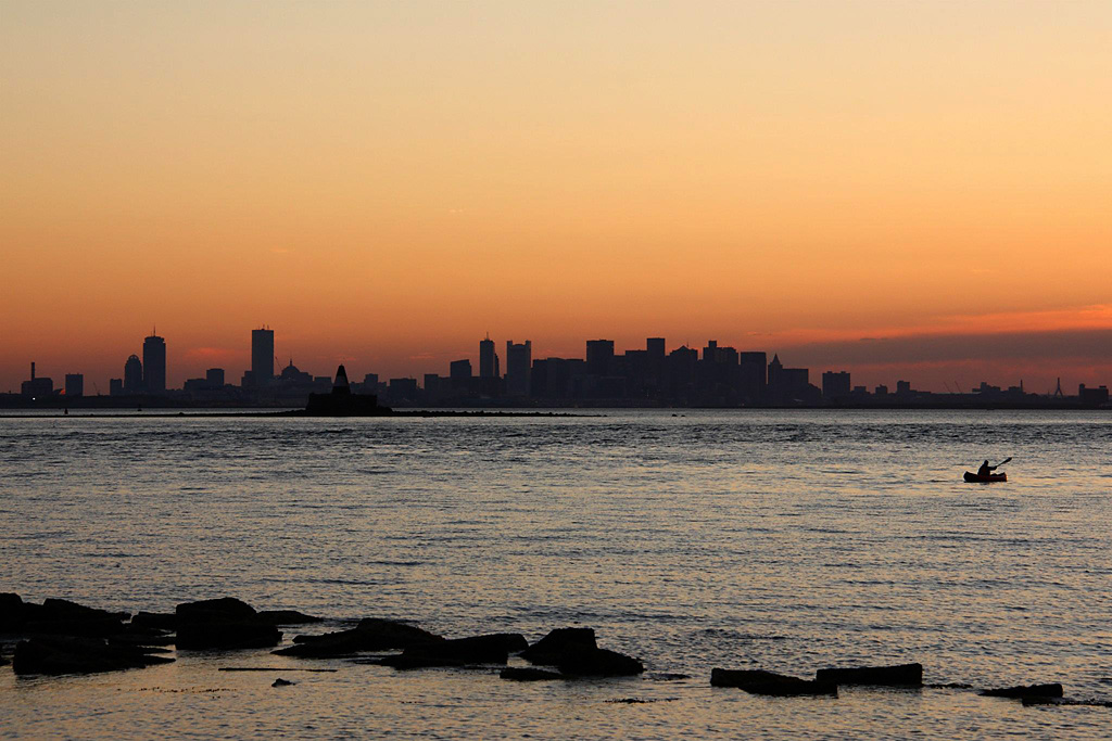
Boston 最美的落日黄昏


 kurtyang04
·
2014-08-27 18:41
kurtyang04
·
2014-08-27 18:41

'在海边升起篝火远眺波士顿Skyline的美景,岸那边灯火通明,是繁华,是诱惑,是人间烟火,岸这边黑暗中繁星点点,是静谧,是安宁,是别有洞天。'
kurtyang04
·
2015-07-10 17:30
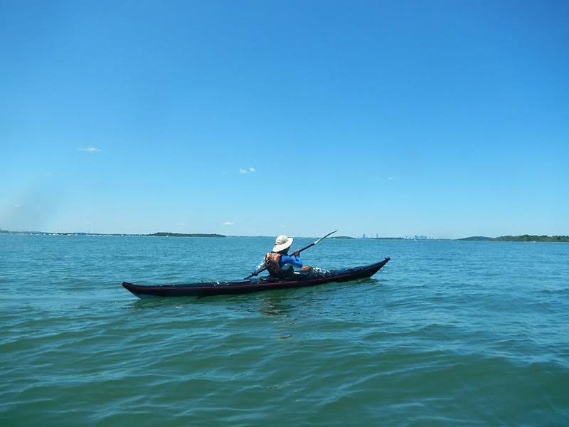
3年过后,我们的装备由全部充气艇到加一两硬艇,再到全部硬艇提升。
来这个系列岛第7次, 新艇新人新景观, 大海丰富和广阔再次给我们新的感受。


没过多久天空乌云密布 , 是暴风雨来临的预兆,于是海湾的那边是风暴中的波士顿 风暴是种美
风暴是种美
那绝对是~
景色真不错。没想到波士顿从外面看起来,更漂亮。
景色真好:heart:
估计有专职摄影师跟队,用单反加上熟练的摄影技术才能拍出这样效果,呵呵。
哈,这个活动我们没有刻意准备,只是带了备用摄影师队员,连三角架都没带,有些照片不是特别清晰。
这真是可遇不可求,往往准备好的活动,没那种戏剧的事件,而人间美景进入人视野时,常常是一种让人吃惊和无准备状态。
大片!透彻,眼前一亮!划艇露营,酷,软艇方向好控制吗?我的软艇k2有风就偏,现在主要都划nemo,但行李又带不了太多,请问多日露营,洗澡的淡水如何解决?